Filter by category and topics
SHOWING 4 OF 4 POSTS
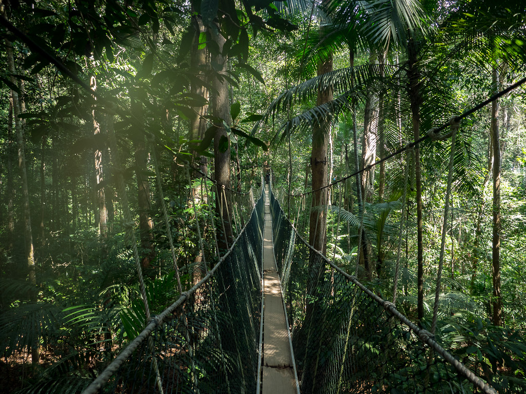
Hutanwatch Spearheads Forest Data Transparency in Malaysia
It started off as a side project. Global Forest Watch (GFW) user, JD*, had a day job at the time — and still does — working with NGOs on forest and land use issues in Malaysia. JD was frustrated with the difficulty of finding reliable maps of forest cover for the country. Much of the […]
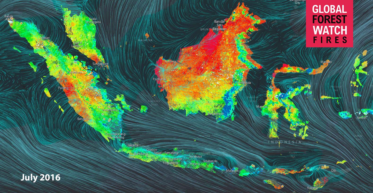
Map of the Week: Viewing Historic Fire Risk in Indonesia
By Sofia Soto Reyes Last year, Indonesia’s fire season was one of the worst on record. As such, vigilance in monitoring weather conditions is crucial. This task has been made easier as GFW Fires recently released a Fire Risk map. Satellite-based data on temperature, humidity, and rainfall is used to estimate how wet or dry tree […]
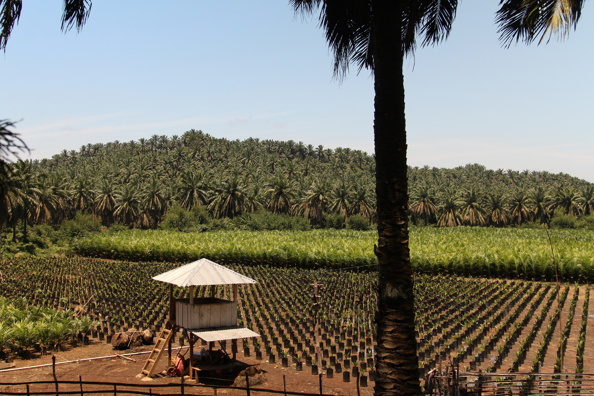
When Tree Cover Loss is Really Forest Loss: New Plantation Maps Improve Forest Monitoring
By Mikaela Weisse The difference between forest and “tree cover” may be subtle, but it is important. Tree cover describes all trees and vegetation taller than 5m (the height at which they can be reliably detected by satellites) regardless of whether they’re part of a natural forest or have been planted by humans for agricultural […]
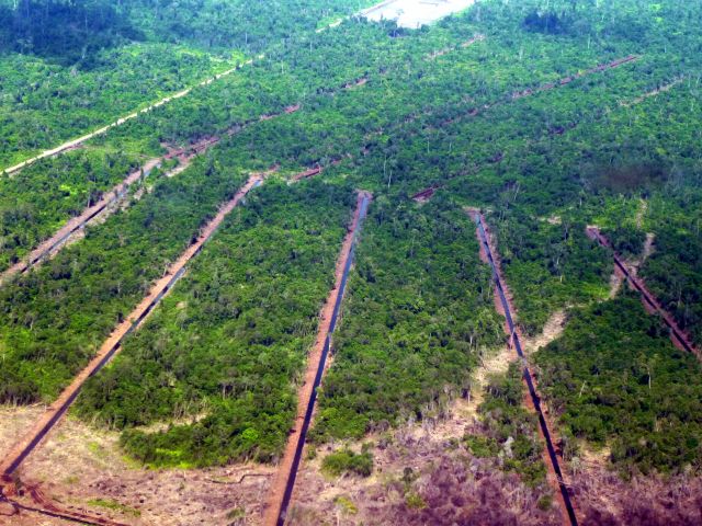
New GFW Maps Show Vast Logging, Oil Palm and Plantation Concessions in Sarawak
By Rachael Petersen, Samantha Gibbes and Mikaela Weisse Sarawak, a Malaysian state on the historically richly forested island of Borneo suffers from high rates of deforestation, but understanding this dynamic is made difficult by government secrecy and lack of transparency. Official maps of logging, oil palm and wood fiber concessions for Sarawak are hard to come by; the government does not […]


