- People
Hutanwatch Spearheads Forest Data Transparency in Malaysia

It started off as a side project.
Global Forest Watch (GFW) user, JD*, had a day job at the time — and still does — working with NGOs on forest and land use issues in Malaysia. JD was frustrated with the difficulty of finding reliable maps of forest cover for the country. Much of the information needed by environmental professionals was scattered across the databases of various NGOs and local governments, and many were reluctant to share. There was simply no authoritative online map.
Then, in 2017, JD came across GFW’s MapBuilder. MapBuilder is a tool that allows users to create custom maps and overlay their own data with the datasets available through GFW. Government agencies in Cameroon, Congo, DRC, Georgia, Liberia, Equatorial Guinea, Gabon and Madagascar have all worked with WRI to employ MapBuilder in the creation of national forest atlases.
But users don’t need the resources of a government agency to make use of MapBuilder. JD saw the potential for the tool to help make work easier. Together, with a small group of volunteers, they searched their networks for available data and compiled a complete national map of legally designated forest areas in Malaysia. JD integrated this layer into the MapBuilder template, giving birth to Hutanwatch, an open data platform for visualizing and analyzing Malaysia’s forest and land use data (‘Hutan’ means forest in Bahasa).
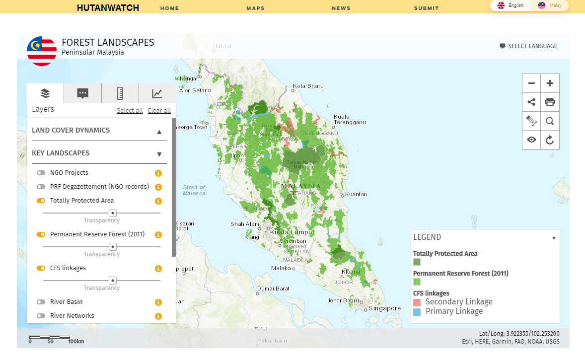 Hutanwatch hosts a variety of interactive maps displaying national and regional data.
 From there, Hutanwatch grew— a news page was added to share insights acquired through analysis of spatial data and a data submission tool to allow the public to submit datasets for inclusion in the platform. Civil society organizations and NGOs in Malaysia began to discover the platform and found it addressed gaps in their work as well. Many users started submitting their own datasets on rivers, river basins and regional datasets on the Sarawak and Sabah regions of Malaysia.
To integrate these user-submitted datasets, Hutanwatch evolved to include multiple thematic maps that display data relevant to different topics or geographic regions of Malaysia. As of 2019, the platform has been visited by over 500 users, and usership is growing. Civil society organizations in Malaysia are actively using the site for reviewing forest reserve boundaries and identifying areas where deforestation might be occurring illegally.
As Hutanwatch gains visibility, JD hopes that it can be a tool to push for greater transparency in forest management. In addition to making spatial datasets publicly available, JD also hopes to build public awareness by providing up-to-date information on large-scale forest activities through the news page.
“As a storytelling tool, [MapBuilder] is very powerful,” JD said. Hutan Watch occasionally receives submissions from users about potentially illicit forest activity, such as active logging sites and clear-cutting activities in forest reserves. Using satellite images and data, Hutanwatch validates these tip-offs, and writes up news stories for the site in order to both notify the public and ask if anyone has further information on the incidents. These news stories sometimes get widely shared through social media.
In one case, Hutanwatch received a submission that indicated planned deforestation adjacent to a state park. Differences between two different forest reserve maps published on the Forestry Department’s website and further investigation revealed approved EIA documents implicating the area. The story sparked media pressure and public outrage, leading the director of the state’s Forestry Department to respond and clarify that the pristine areas (3,811 hectares instead of the alleged 6,000 hectares) slated for conversion were beyond the buffer zone of the state park.
The growth of technology has made it easier than ever for anyone to develop customized, localized forest and land use monitoring platforms. GFW MapBuilder integrates with ArcGIS Online (a free, public tool) allowing users to build a forest monitoring platform without any need for programing.
JD hopes this simplicity will encourage the development of more official monitoring platforms.
“If one person without any formal GIS or programming background built Hutanwatch, there’s no reason why the government agencies can’t develop something more sophisticated to remain accountable to the public.”
Users who are interested in learning more about how to use GFW MapBuilder can explore the GFW how-to tutorials for both public and organization ArcGIS Online accounts or visit the GFW website.
*name has been abbreviated to protect privacy
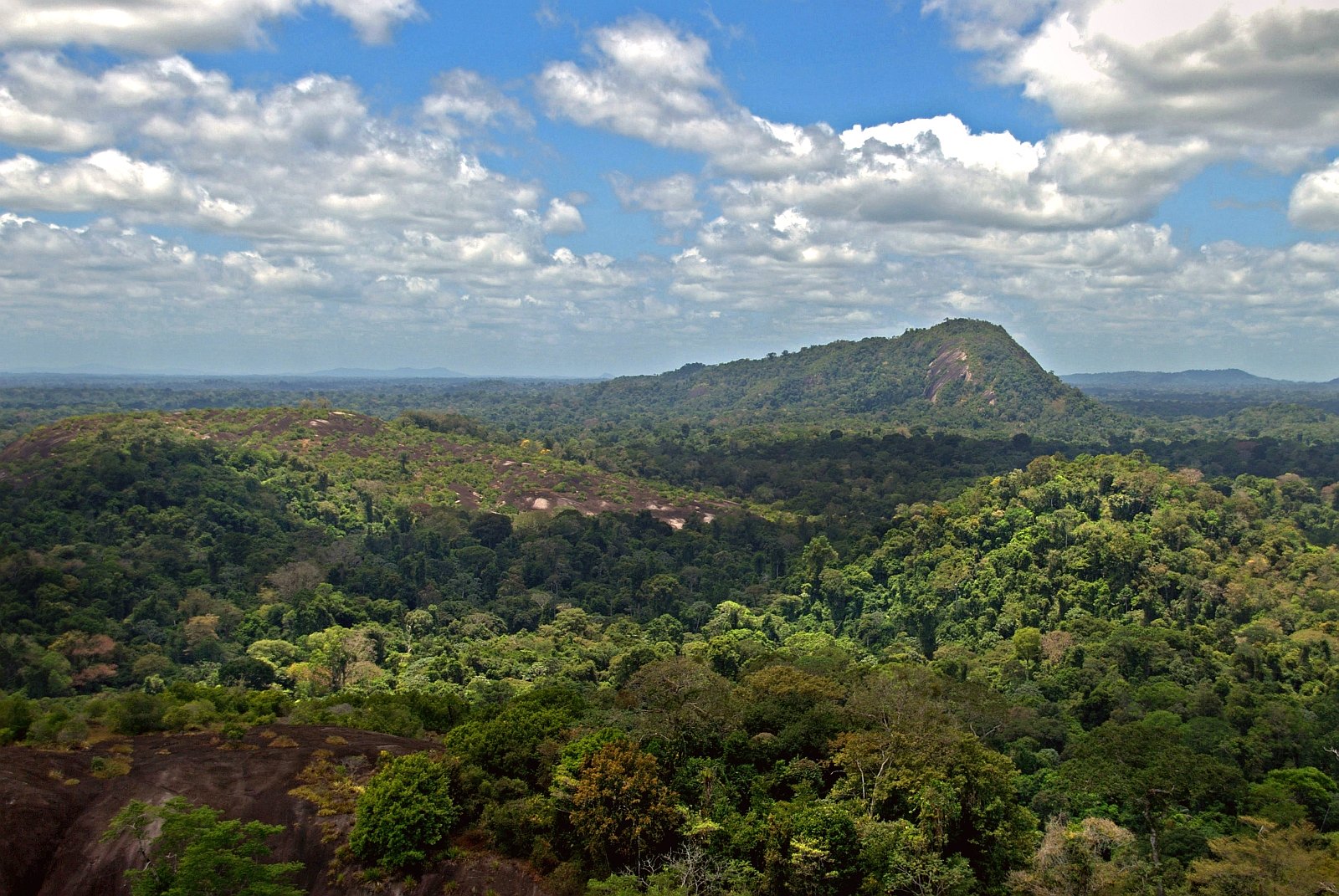
BANNER PHOTO: Forest bridge in Malaysia. Photo by Bruno Kehrli/Flickr.
Explore More Articles
Explore More Articles


