- Commodities
- Map of the Week
Map of the Week: Tracking Logging Roads in the Congo Basin
Oct 11, 2016||3 minutes
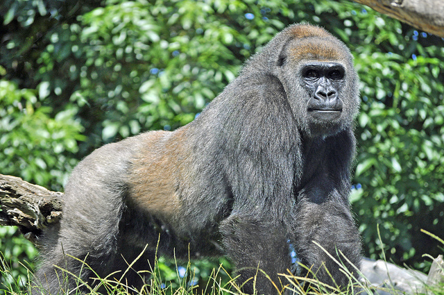 Western Lowland Gorilla (in captivity). Source: Heather Paul (
Located in western equatorial Africa is a vast expanse of green that blankets six Congo Basin countries: Cameroon, Central African Republic, Equatorial Guinea, Gabon, Democratic Republic of the Congo and Republic of the Congo. Second only to the Amazon rainforest in size, the Congo Basin rainforest is one of the most important forests in the world boasting some 10,000 animal species, including elephants, gorillas, chimpanzees, hippos and lions, as well as more than 600 species of trees. A recent study found that trees in the Congo Basin grow bigger and taller than those in other tropical rainforests thanks to its wildlife, which help to clear away smaller trees competing for space and sunlight. As a result, the Congo Basin rainforest is full of old growth trees that store huge volumes of carbon.
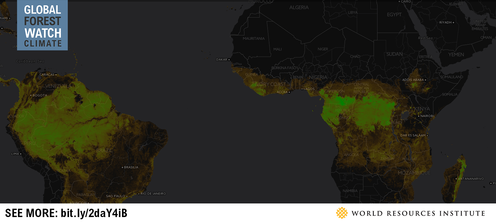
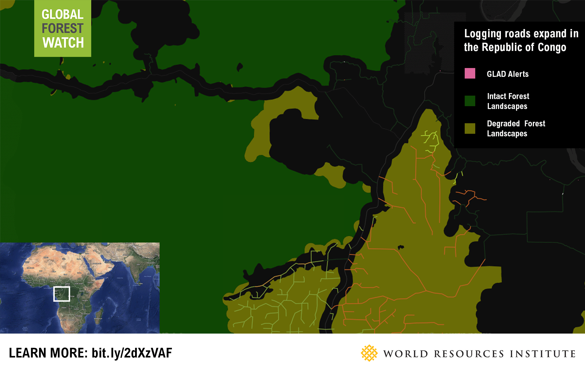
The aboveground live woody biomass layer on Global Forest Watch (GFW) Climate shows just how much carbon is stored in the Congo Basin and other forests across the tropics. The data display the amount of carbon stored in live woody biomass (trees and woody plants found in a forest) using a color gradient—the brighter the green, the more carbon is stored in the area. We can thus visually compare the carbon stores of Amazon (left) with those of the Congo Basin (right) and easily see that the Congo Basin has a higher density, reinforcing the importance of this region for climate mitigation. This rainforest is also an economic engine in the region. Central African countries produce roughly 80 percent of all African timber. Although relatively small on the global scale, this production is significant regionally as logging alone makes up 6 percent of the GDP in Cameroon, Central African Republic and the Republic of Congo and employs more than 50,000 people across the Congo Basin. But these economic benefits can be at odds with the forest’s ecological importance. Industrial logging is the primary cause of forest degradation in the Congo Basin as logging roads make previously remote forest areas more accessible for further development or hunting, both of which have major repercussions. For example, increased hunting has led to a 62 percent decline in the region’s elephant population in just the past decade, and cutting down more carbon-dense forest can lead to greater emissions. GFW’s Congo-specific logging concessions layer, the Congo Basin logging roads layer and GLAD alerts detail the development of these consequential roads in near-real-time. For instance, users can monitor the logging concessions in central Republic of Congo, which have extensive logging road networks. Data on GFW show when these roads were first detected—many within the past year—and the loss that surrounds them. In the Ngombe concession, much of the most recent tree cover loss alerts are concentrated in the middle of its road network reinforcing the fact that logging roads are often the precursor to forest loss and degradation. Data also show that there are many relatively new logging roads outside concession areas in the Congo Basin. So, while the region currently has the lowest rate of deforestation in the tropics, there is a risk that the rate could go up in unlicensed areas.
Be part of the solution
Because roads are the main catalyzers of deforestation, monitoring their development and providing timely data to law enforcement and forest managers is critical to maintaining the integrity of the Congo Basin forest. Users can help map logging roads in the Congo Basin through the Logging Roads initiative, a partnership between Moabi and GFW that crowdsources volunteer analysis of satellite imagery to trace and date logging roads in the Congo Basin. The resulting data is made available on GFW for easy access and analyze along with other contextual data such as protected areas, concessions and primary forest layers. Try your hand at updating logging roads in the Ngombe concession and elsewhere in the Congo Basin here!
Explore More Articles
Jan 18, 2017|Commodities|2 minutes
Partnership Launches to Increase Transparency and Traceability Across Supply Chains and Meet Zero-Deforestation Commitments
Read the full concept note. On January 19 at the World Economic Forum in Davos, Switzerland, 20 of the world’s largest commodity producers, traders, manufacturers, consultants and retailers launched a new partnership with research institutions and banks to monitor deforestation and manage sustainability from farm to customer. The partnership, led by the GFW team (see the […]
Dec 20, 2016|Commodities|5 minutes
Technical Blog: Soy Data for Brazil’s Cerrado
By Sarah Sargent and Ryan Sarsfield Taken by Paulo Q Maia (Flickr). License information here. Global Forest Watch (GFW) Commodities recently released new data and analysis for soybean production in Brazil’s Cerrado biome, a mix of forest and savannah rich with biodiversity and carbon. These data show users the spatial extent of soy production and how […]
Dec 20, 2016|Commodities|4 minutes
Companies Can Find Deforestation-Free Soy in Brazil’s Cerrado, Thanks to New Data
By Ryan Sarsfield Cerrado Parque Estadual dos Pirineus by Jonathan Wilkins via Wikimedia. The photo is licensed under the Creative Commons Attribution-Share Alike 3.0 Unported license. Just ten years ago, Brazilian soy’s reputation was at an all-time low for its links to deforestation in the Amazon. The industry, environmental NGOs and the Brazilian government reacted swiftly to establish […]
Explore More Articles


