- Fires
New High-Resolution Images of Indonesian Forest and Land Fires
Nov 21, 2014||1 minute
http://www.wri.org/blog/fires-indonesia-spike-highest-levels-june-2013-haze-emergency
-Rini Sulaiman
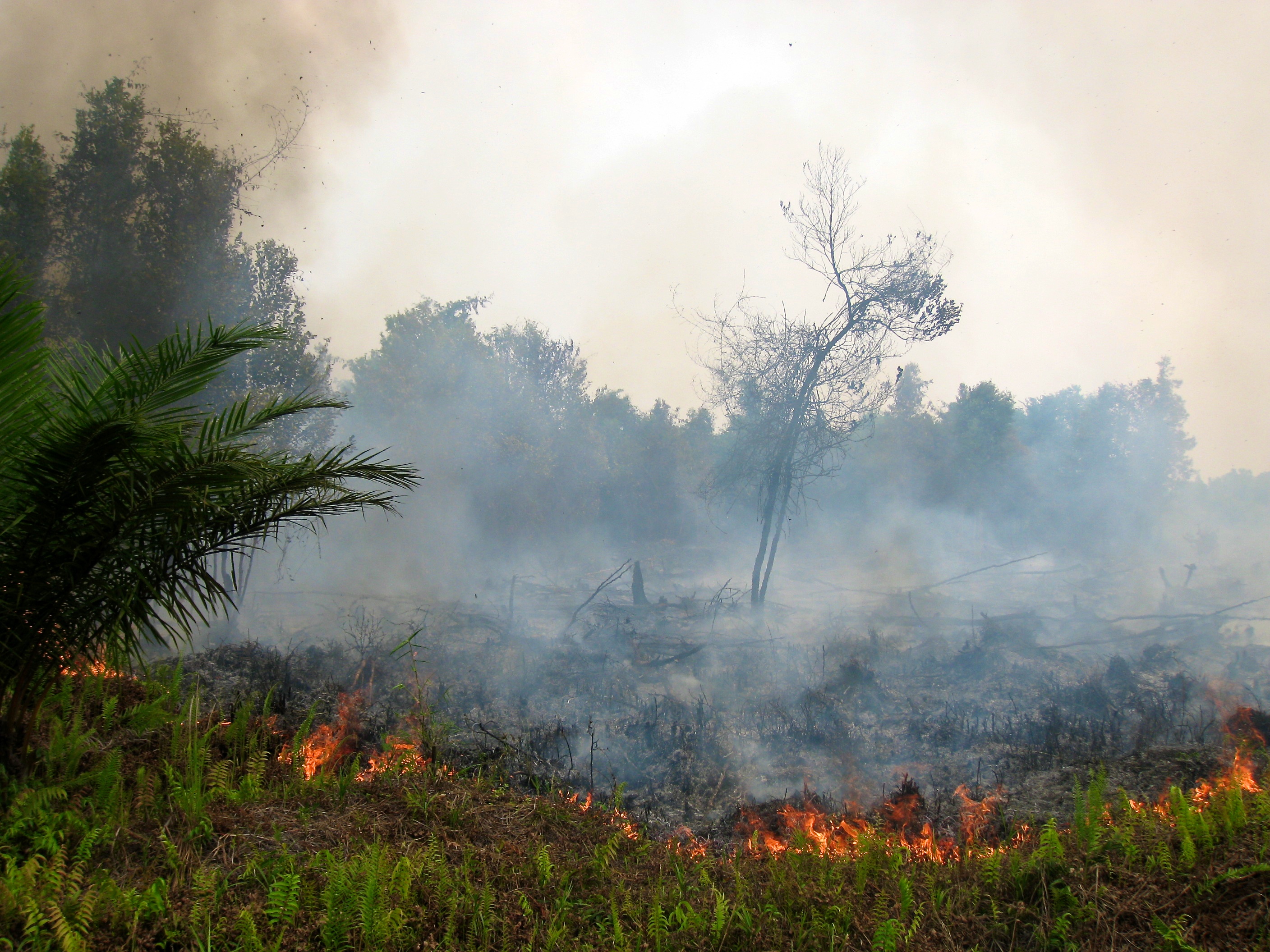
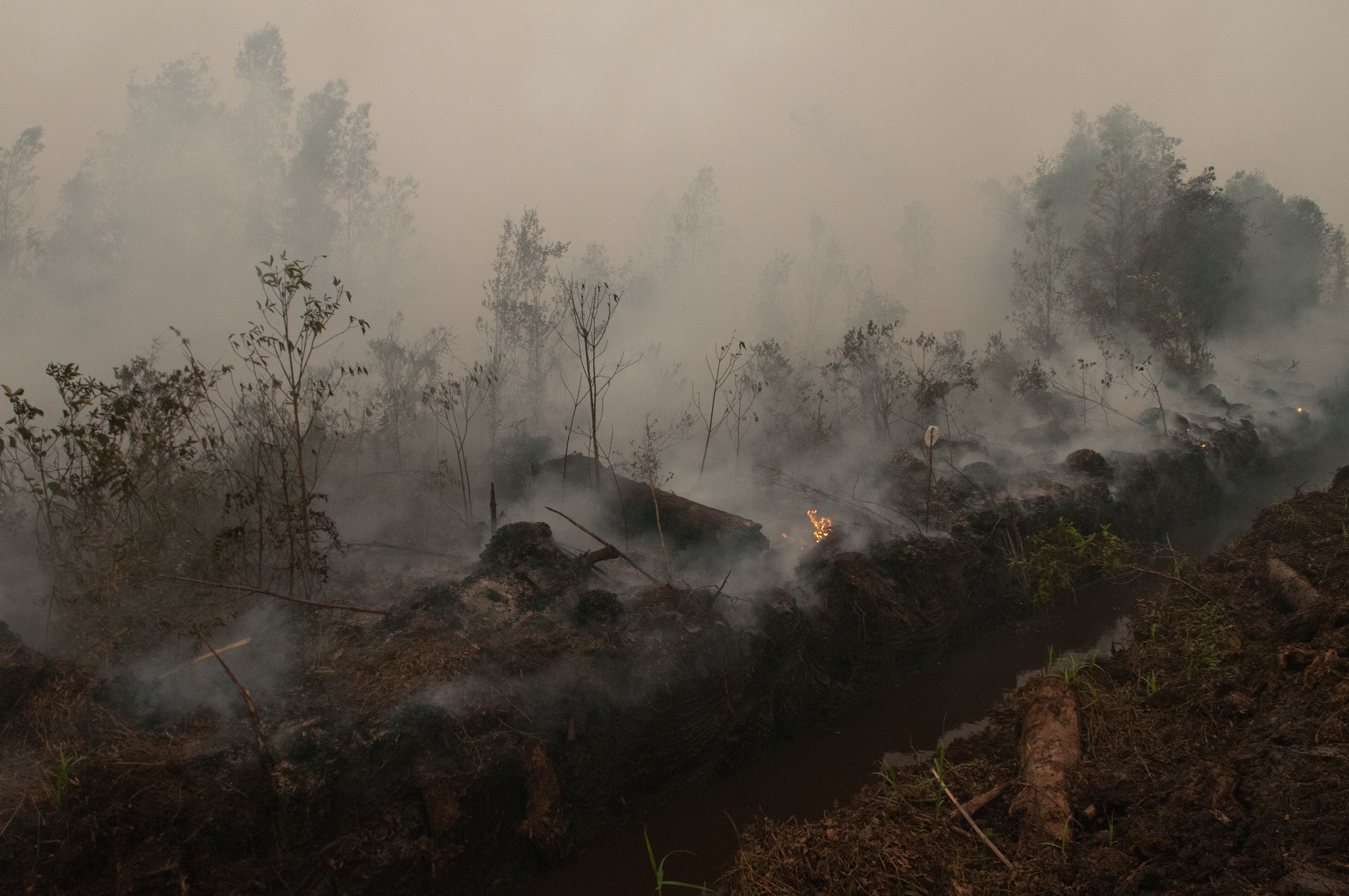
By James Anderson and Asa Strong Global Forest Watch and Digital Globe recently partnered to bring high-resolution satellite images to bear on the issue of forest and land fires in Indonesia. The fires, often set to clear land for agriculture or used as a tool in conflict over land, can cause serious damage to forests and peat soils, as well as releasing clouds of toxic haze. The haze remains a particularly acute environmental and public heath crisis. We have continued to acquire new images, including new images from the past few weeks. See two highlights below, complete with lat/ long coordinates and links to download the images on Flickr, or explore them with other forest and land data on GFW Fires. Fire near wood fiber plantation | Sumatra, Indonesia | Nov 5, 2014
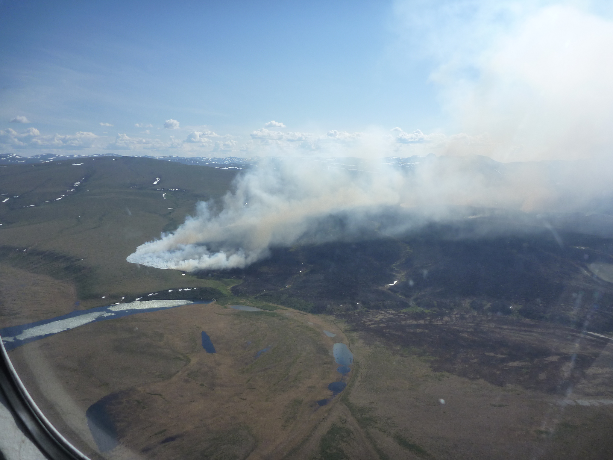
 Land fire in Sumatra, Indonesia, made available through a partnership between Global Forest Watch Fires and Digital Globe. The dark patches on the left are a large pulpwood plantation (concession boundaries available on GFW fires).
 Acquisition Date: November 5, 2014 Satellite: Digital Globe’s WorldView 2 Lat/ Long: 105.764057 / -2.848973 (Decimal Degrees) Explore this image and additional data on Global Forest Watch Fires Download the high-resolution image via Flickr Fire in fields | Sumatra, Indonesia | July 24, 2014
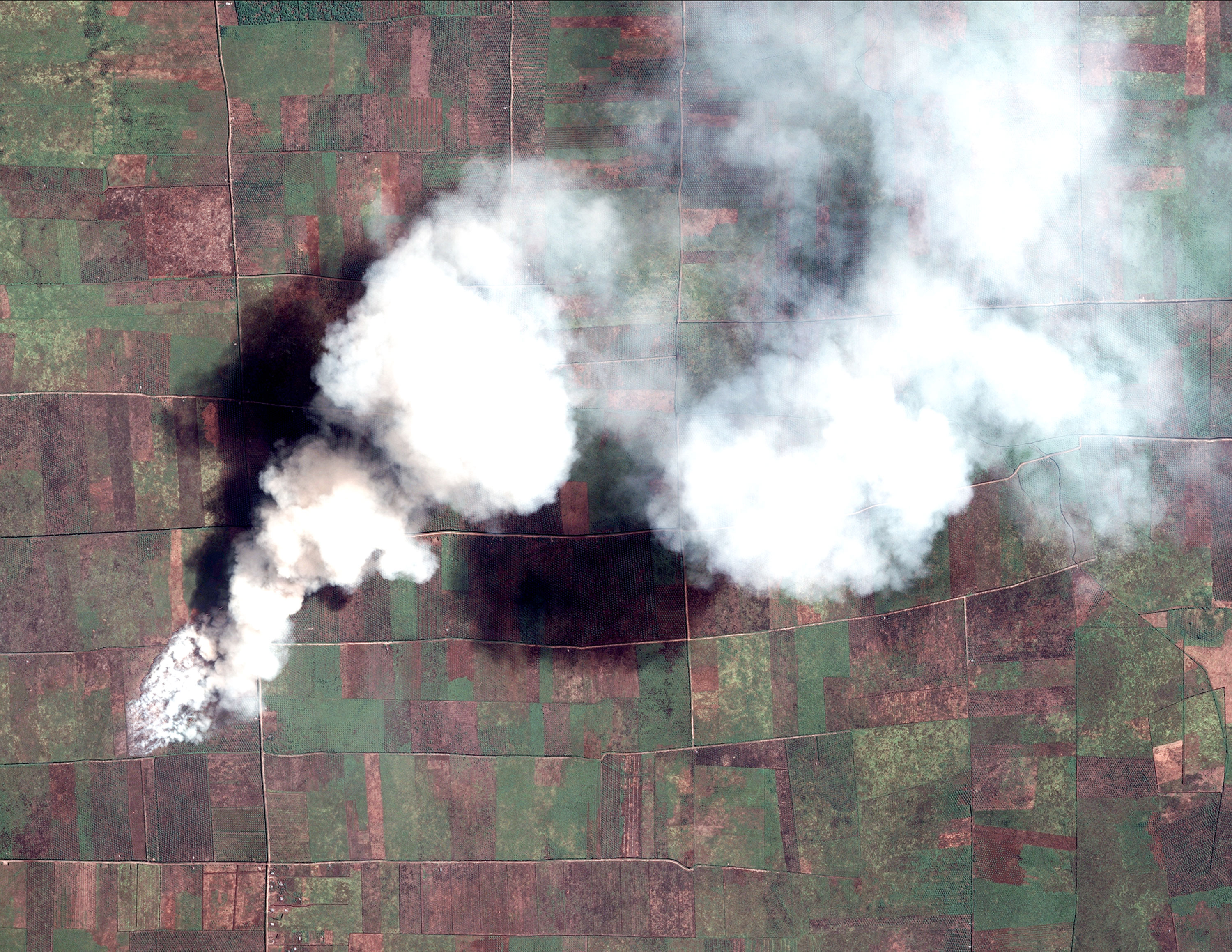 Land fire in Sumatra, Indonesia, made available through a partnership between Global Forest Watch Fires and Digital Globe. The dark patches on the left are a large pulpwood plantation (concession boundaries available on GFW fires). Agricultural fire in Sumatra, Indonesia, made available through a partnership between Global Forest Watch Fires and Digital Globe.
 Acquisition Date: July 24,2014 Satellite: Digital Globe’s WorldView 2 Lat/ Long: 100.371870 / 2.103892 (Decimal Degrees) Explore this image and additional data on Global Forest Watch Fires Download the high-resolution image via Flickr Feel free to share and re-post the images (with credit to Global Forest Watch and Digital Globe).
Explore More Articles
Mar 08, 2016|Fires|1 minute
PARTNER POST: Map of the Week: Congo Basin forest fires of unprecedented extent detected by UMD GLAD alerts
By the UMD Global Land Analysis and Discovery team The new UMD GLAD Landsat-based 30-m forest disturbance alerts detected one of the largest forest fires ever observed in the rainforests of Central Africa. Landsat-based alerts were confirmed by active fire detections from the MODIS and VIIRS sensors. More than 15,000 ha of upland open canopied forests […]
Oct 26, 2015|Fires|4 minutes
3 Ways Obama Could Help Fight Indonesia’s Massive Fires
By Nigel Sizer, Fred Stolle and Tjokorda Nirarta “Koni” Samadhi Children are forced to wear masks due to the toxic smoke from peat land fires. Palangka Raya, Central Kalimantan. Courtesy of CIFOR (Flickr) As President Obama and Indonesian President Joko Widodo meet today, climate change will be high on their agenda. A related, unexpected issue should also be on […]
Sep 03, 2015|Fires|5 minutes
Fires Heat Up as El Nino Develops – Growing Health Concerns as Haze Worsens
By Susan Minnemeyer, Lisa Johnston and Tania Firdausy Indonesia fire alerts spiked to their highest level of the year yesterday, amid forecasts that the developing El Nino may be even stronger than the 1997-98 warming that led to Indonesia’s most catastrophic fire season. With 461 high confidence* fire alerts, today’s count is the highest since the peak of […]
Explore More Articles


