- Insights
As Indonesia’s Dry Season Looms, a New Tool Can Predict Daily Forest Fire Risk
Jul 07, 2016||5 minutes
Susan Minnemeyer, Sarah Sargent, Karyn Tabor and Greg Soter
Languages
By Susan Minnemeyer, Sarah Sargent, Karyn Tabor and Greg Soter
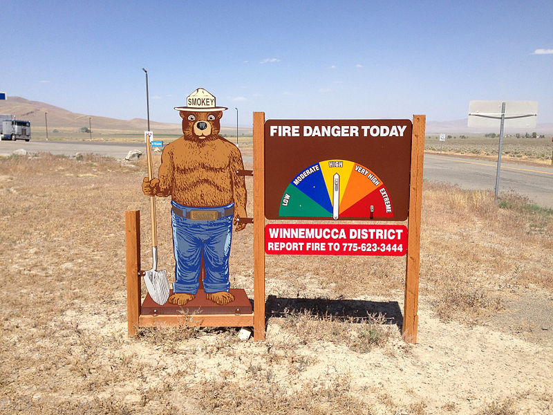 Smokey the Bear fire danger sign in Paradise Valley, Nevada. Photo credit: Famartin / Wikimedia Commons.
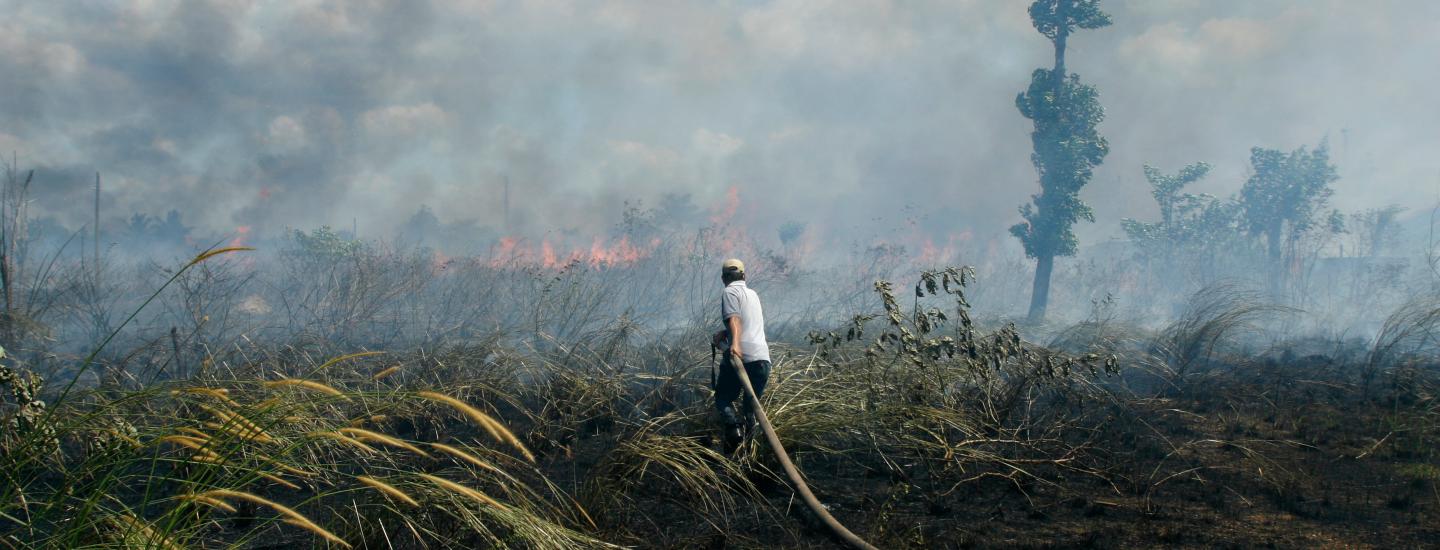
This summer, visitors to U.S. national parks and forests will be greeted by Smokey the Bear, the Forest Service’s beloved mascot, delivering a warning about the day’s fire danger. Those warnings are important—signs point to another record fire year for the country. But this summer, many of the world’s most damaging fires may actually occur halfway around the world in the forests and peatlands of Indonesia. Last year, Indonesia’s forest and land fires emitted more than the entire U.S. economy on a daily basis for half the summer. Toxic smoke and haze afflicted hundreds of thousands, disrupting the economy, triggering respiratory problems and even causing deaths. Could this crisis be averted if Indonesia had its own version of Smokey the Bear’s daily fire danger warnings? The new Fire Risk Map on Global Forest Watch Fires aims to provide a Smokey for Southeast Asia. Every day, a computer model generates a new interactive map showing where dry conditions increase fire risk in Indonesia and Malaysia. The tool can help decision-makers take action to prevent fires before they ignite.
How the Map Works
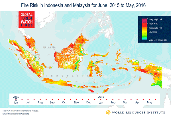
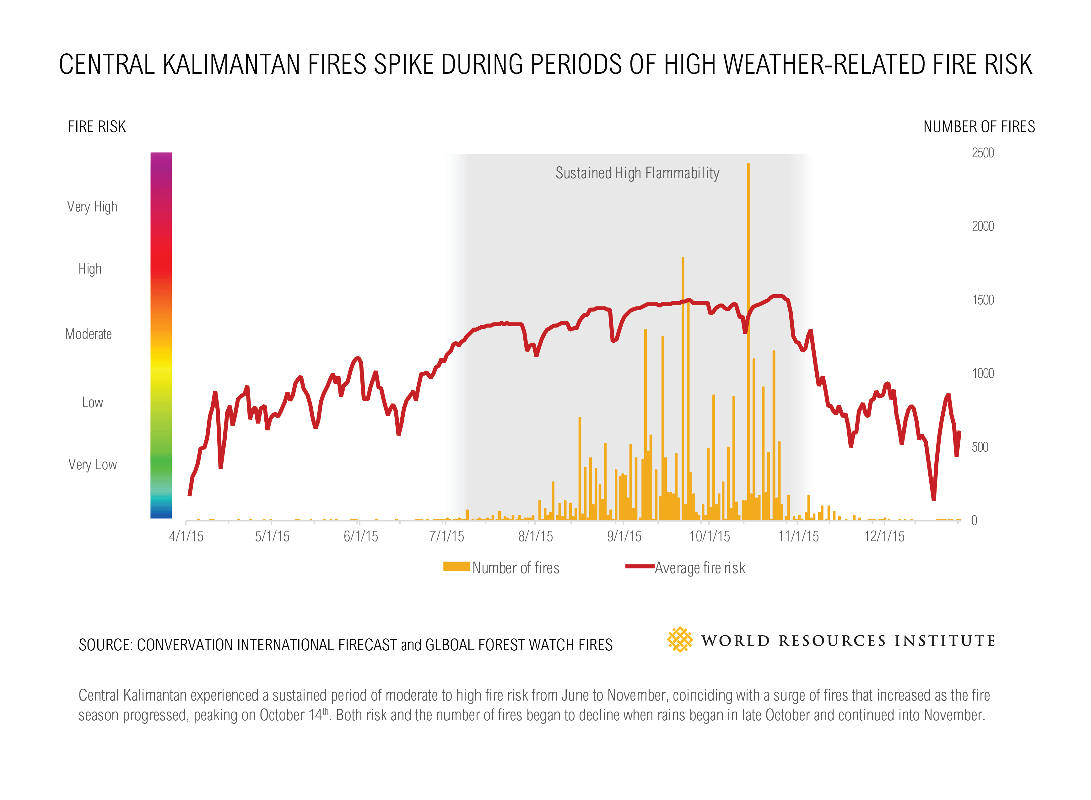
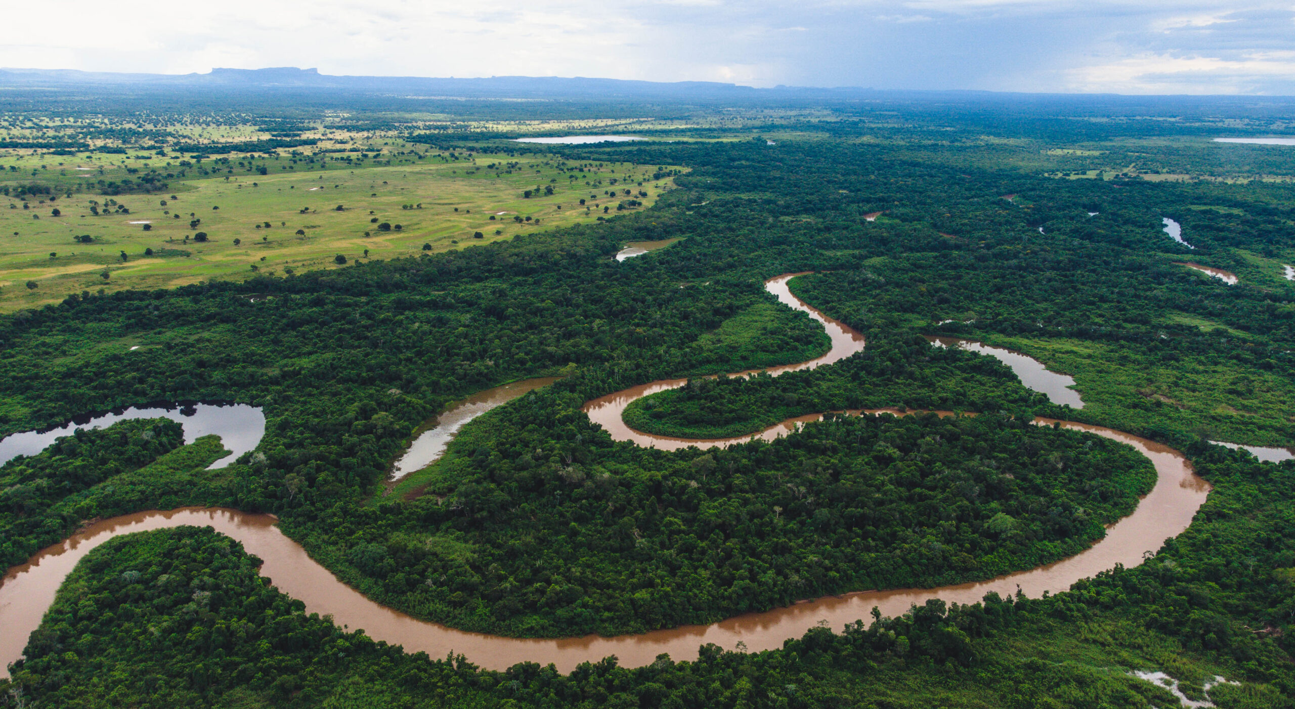
Experts with Conservation International’s Firecast initiative, the Global Solutions Group and WRI developed the fire risk map based on the U.S. Forest Service’s Fire Danger Rating System. It calculates the risk of a fire catching and spreading in a given area using satellite-based data on temperature, humidity and rainfall. These metrics help estimate how wet or dry forest litter (dead tree and plant materials) is—the drier the litter, the higher the risk. As the chart below shows, when you have sustained periods of high flammability such as last season’s El Niño conditions, fires can quickly surge. Last year, Central Kalimantan, which experienced the greatest number of fires, sustained a moderate to high average fire risk score for a period of 143 days from June 21 until Nov 11, resulting in 29,785 fire alerts.
Of course weather isn’t the only factor determining whether fires will take hold. Most of Indonesia’s forest fires are human-caused, usually to clear forests for agricultural and forestry activity. But levels of dryness affect whether these fires will spread and surge out of control. With daily warnings on when and where land is most flammable, government agents, companies and communities can channel resources to areas most likely to burn.
What to Expect in 2016
Indonesia is currently entering its dry season (June to October), when fires typically spike and air quality deteriorates. However, El Niño, a cyclical climate event which warms sea temperatures and led to dry conditions in 2015, has now largely ended. Instead, there is a 75 percent chance of La Niña, the cooler inverse of El Niño, which would create wetter-than-average conditions for Indonesia and perhaps a shorter dry season. So far in 2016, most of Indonesia has been relatively rainy and with few fires, although conditions are growing drier. The new fire risk data shows that average fire risk is at moderate to low in provinces that saw significant fire outbreaks last year, but beginning to enter high-risk conditions in portions of Riau Province and Central and West Kalimantan.
Preventing Future Fire Outbreaks
Signs of lower fire risk should not be cause for complacency. It is cheaper to prevent fires than react to them, and this fire season could present an opportunity to tackle the roots of the problem.
Land managers can take proactive actions to prevent fires during periods of high fire risk:
- Take preventative measures. For example, APRIL, a company with extensive pulpwood concessions across Riau Province in Indonesia, is already implementing fire prevention measures for when conditions grow excessively dry. The company is blocking drainage canals to raise the water table in plantations to reduce chances of fires igniting.
- Subscribe on GFW Fires to be alerted by email or SMS as soon as fires are detected, and quickly send firefighters to contain the fires. Soon, you will also soon be able to subscribe to alerts for high fire risk.
- Work with local communities around plantation areas. Smallholders and communities may not have the same capacity or tools as a large company, and may need to borrow land-clearing equipment or gain knowledge from businesses on how to prevent fires.
Government agencies can also be proactive:
- Inform the public when fire risk is high. In the United States, fire danger warnings help forest users know whether it is safe to build a campfire or operate certain equipment. Similar warnings or prohibitions on fires on dry days could help raise awareness. Public campaigns could also educate farmers on using non-fire methods to prepare their land for agriculture.
- Require plantation companies to develop fire management plans and implement fire prevention actions. This could including requiring companies to maintain adequate fire response capacity, such as hiring firefighting staff and experts.
- Coordinate fire response actions when fires occur to prevent spreading. National agencies should work closely with local governments, and may also accept assistance from other national governments in the form of funding, equipment or investigations into companies or individuals implicated in fires.
Global Forest Watch and Conservation International plan to continue working together to build on this effort, including potentially expanding to other geographic regions. We welcome your input on how this information could be useful to your work. To learn more about the fire risk map, read the Conservation International publication, “A satellite model of forest flammability,” and visit the Firecast website. Download daily fire risk or days since last rainfall maps through GFW’s Open Data Portal.
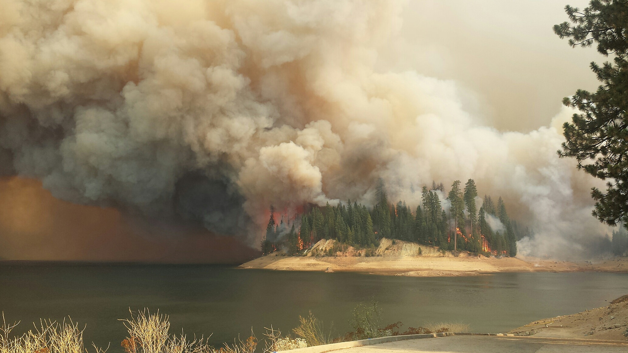
Karyn Tabor works at Conservation International on the development of their Firecast tool. Greg Soter is a GIS programmer who adapted the Firecast model for Indonesia. This article originally appeared on WRI Insights. BANNER PHOTO: The King Fire, which burned Sept/Oct 2014 on the Eldorado and Tahoe National Forests. Photo by USFS Region 5 (Flickr).
Explore More Articles
Explore More Articles


