- Fires
3 Ways Obama Could Help Fight Indonesia’s Massive Fires
Oct 26, 2015||4 minutes
By Nigel Sizer, Fred Stolle and Tjokorda Nirarta “Koni” Samadhi
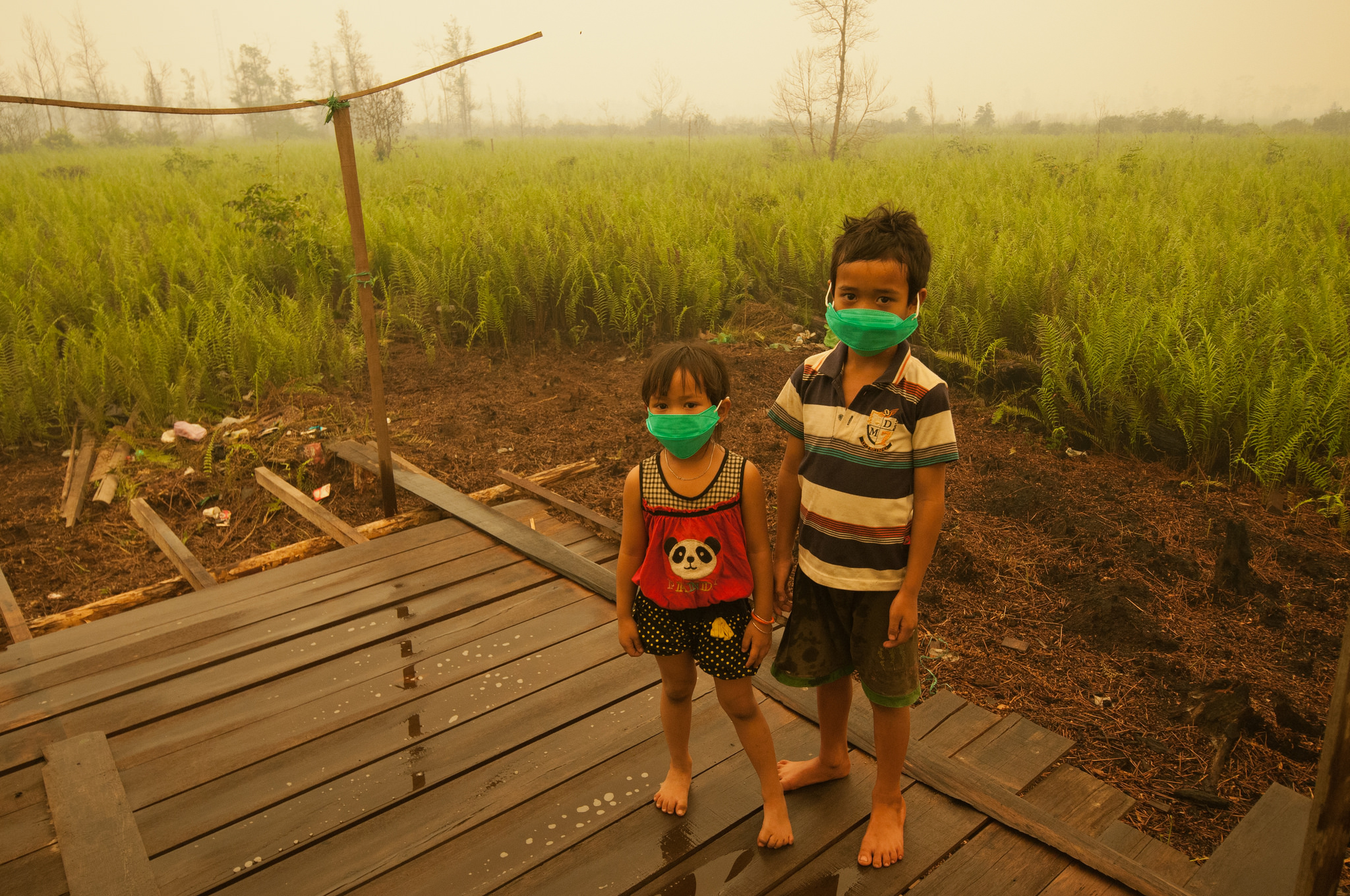 Children are forced to wear masks due to the toxic smoke from peat land fires. Palangka Raya, Central Kalimantan. Courtesy of CIFOR (Flickr)
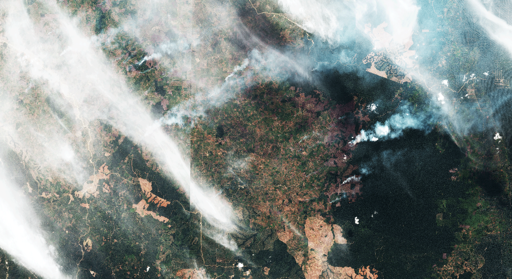
 As President Obama and Indonesian President Joko Widodo meet today, climate change will be high on their agenda. A related, unexpected issue should also be on their radar: massive forest and land fires that have turned into a national, regional, and now global crisis for the new Indonesian administration. The fires in Indonesia are truly out of control, having spiked in recent weeks to their highest levels in years. More than300,000 Indonesians have sought medical help for respiratory illnesses linked to the choking haze. Pollution levels are up to five times above what the World Health Organization considers to be hazardous levels. Schools and airports have been closed. The Indonesian government has already spent about $200 million to fight the fires and has recently accepted help from Singapore, Malaysia, and Australia. Yet this year’s fires will likely keep burning for at least another month. The total economic costs may exceed $14 billion. Further, the fires, which are largely burning on high-carbon peatland, have caused a spike in greenhouse gas emissions. New analysis finds several days recently where Indonesia’s greenhouse gas emissions from fires surpassed the daily level of emissions of the entire U.S. economy. These fires in Indonesia do not occur naturally. They are largely the result of a history of destructive land management, poor law enforcement, inadequate preparation, and sheer bad luck with an extended dry season caused by the El Niñonow upsetting weather patterns globally. When the presidents meet, they should work together to respond to this crisis and reduce the risks of future fires. The U.S. can support better land management in Indonesia in three keys ways:
- Encourage responsible market forces and financial incentives: The United States can join global efforts to encourage more sustainable production of commodities like timber, pulp and paper, and palm oil. Forthcoming analysis from the World Resources Institute shows that company concessions certified as “sustainable” by the Roundtable on Sustainable Palm Oil have a markedly lower number of fires. Strong certification standards also exist for other products, including wood and paper. Consumers in the United States, including the government, buy vast quantities of paper, packaging and products containing palm oil — which is found in everything from shampoo to candy bars — and could give preference to manufacturers that source certified materials. This would send a signal to producers in Indonesia who manage vast areas of land. An even bolder move could be for the United States to join Norway in contributing“pay for performance” incentives if Indonesia achieves key milestones in better managing its forests and reducing emissions.
- Provide technical and scientific support: The U.S. government could expand technical support to Indonesia, like current projects by the U.S. Agency for International Development, on land use management and emissions reductions. Land conflict is often an underlying condition of fires in Indonesia. More resources are needed for Indonesia’s “One Map” initiative to resolve land conflicts by creating a single consistent and harmonized map of land use and ownership for all government agencies to work from. In addition, Indonesia needs support to better monitor its emissions from peat soil decomposition and burning. One idea would be to create competition for funding among U.S. and Indonesian universities to find creative solutions to these knotty technical challenges.
- Advance innovative technology: More U.S. support in technology should be marshalled. Leading technology companies, including Google, Esri, and satellite-operator Digital Globe, are already assisting with the fire-fighting effort by providing technology and expertise to Global Forest Watch, a platform coordinated by WRI that provides real-time maps and updates on the fires. An electronic permitting system in Indonesia would be extremely useful to streamline the murky world of licenses and maps for palm oil, pulpwood and logging concessions, which cover more than half of Indonesia’s forest land. Government, business and civil society should work together to develop procedures and systems for transparent, corruption-free land-use licensing.
The timing of this visit between Obama and Widodo is fortuitous. Obama, of course, is very familiar with Indonesia, having spent some of his childhood years in the country. Now he has a chance to strengthen America’s ties with Indonesia, which is the second-largest democracy in Asia and has the fourth-largest population in the world. Together, these two leaders can deepen a partnership that will help improve the health of Indonesians, reduce greenhouse gas emissions, enhance sustainable commodity production, and lead to a healthier world for us all.
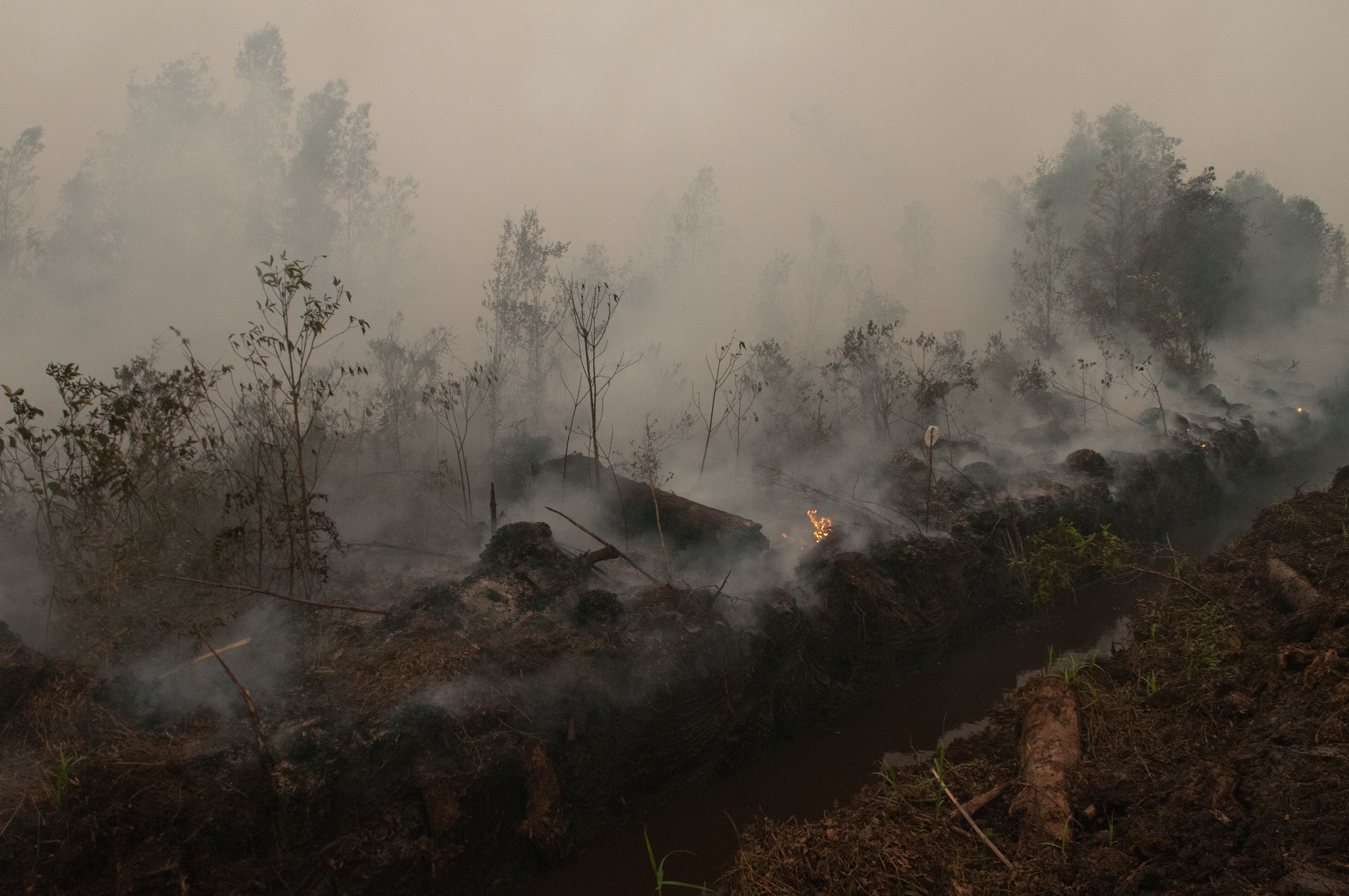
This article originally appeared on the Huffington Post and Grist BANNER PHOTO: Fires rage on peat lands outside Palangka Raya, Central Kalimantan. Courtesy of CIFOR (Flickr).
Explore More Articles
Mar 08, 2016|Fires|1 minute
PARTNER POST: Map of the Week: Congo Basin forest fires of unprecedented extent detected by UMD GLAD alerts
By the UMD Global Land Analysis and Discovery team The new UMD GLAD Landsat-based 30-m forest disturbance alerts detected one of the largest forest fires ever observed in the rainforests of Central Africa. Landsat-based alerts were confirmed by active fire detections from the MODIS and VIIRS sensors. More than 15,000 ha of upland open canopied forests […]
Sep 03, 2015|Fires|5 minutes
Fires Heat Up as El Nino Develops – Growing Health Concerns as Haze Worsens
By Susan Minnemeyer, Lisa Johnston and Tania Firdausy Indonesia fire alerts spiked to their highest level of the year yesterday, amid forecasts that the developing El Nino may be even stronger than the 1997-98 warming that led to Indonesia’s most catastrophic fire season. With 461 high confidence* fire alerts, today’s count is the highest since the peak of […]
Jul 20, 2015|Commodities|1 minute
UPDATE: New Satellite Imagery Captures Fires and Extensive Forest Loss Within Tesso Nilo National Park
By Susan Minnemeyer and Octavia Payne Newly acquired Digital Globe satellite imagery captures the full extent of Tesso Nilo National Park during the recent fire outbreak from late May to mid-July 2015. Recent rainfall has greatly reduced the extent of the fires, but three hotspots were still visible as of today. Explore in detail on Global […]
Explore More Articles


