- Data and Research
Monitoring Forest Change in Latin America with Terra-i
Dec 09, 2014||4 minutes
By Hayley Solak, Ruth Nogueron and Sarah Mann
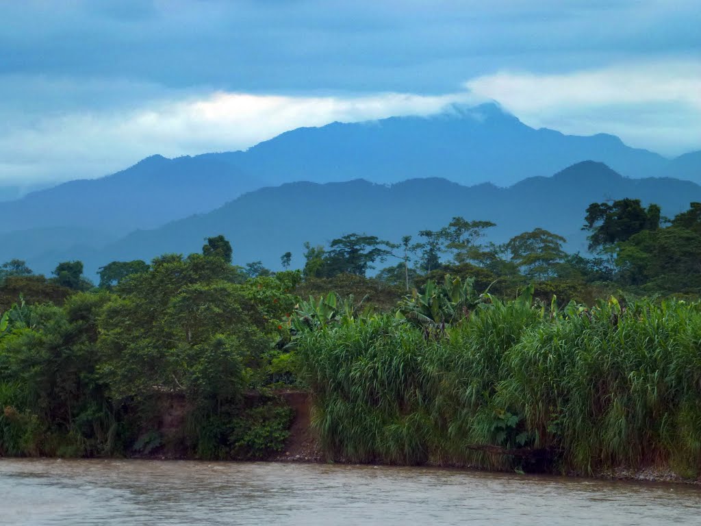 (Shampuyacu, Peru) Photo by Bruno Locatelli/CIFOR.
 Alert systems that quickly connect observers to the location of tree cover loss can help forest managers respond to threats with precision and speed. These alerts allow large-scale monitoring of tree cover loss using satellite datasets and sophisticated computer algorithms to understand how the forest is changing over time, without having to trek through remote areas or wait for yearly data updates. A new collaboration between World Resources Institute and the International Center for Tropical Agriculture (CIAT) lets users of the Global Forest Watch (GFW) platform visualize and analyze tree cover loss alerts for all of Latin America with a near-real time deforestation monitoring system called Terra-i. A project of CIAT, Terra-i is a pivotal addition to the GFW platform. It enables users to put tree cover loss alerts into context with data on relevant forest cover, community and biodiversity for an increased understanding of where—and why—forests are disappearing. Terra-i is the highest-resolution alert system on GFW, with resolution as high as 250 meters (273 yards), and able to deliver updates monthly. Because forest monitoring technology is in its early stages, multiple alert systems on a single platform help users compare and contrast results. Terra-i’s algorithm is specifically calibrated for Latin America, it has a high level of accuracy, and there are plans to expand the system next year to cover the pan-tropics at the same high resolution.
Monitoring Forest Cover from Space
Terra-i uses satellite imagery from NASA’s MODIS (Moderate Resolution Imaging-Spectrometer) and TRMM (Tropical Rainfall Measuring Mission) sensors to detect tree cover loss through a computational algorithm designed to detect changes of greenness over time and relate them to rainfall. When a significant deviation from normal vegetation patterns occurs, the area of change is marked, resulting in an alert on the GFW map. With the addition of Terra-i near-real time alerts, Global Forest Watch now offers four tree cover monitoring systems that generate periodic alerts for Latin America.
| Monitoring System | Periodicity | Resolution | Geographic Coverage |
|---|---|---|---|
| Terra-i | Monthly | 250 meters | All of Latin America |
| FORMA | Monthly | 500 meters | Global Humid Tropics |
| UMD-Google | Annual | 30 meters | Global |
| SAD | Monthly | 250 meters | Brazilian Amazon |
GFW users can compare these monitoring alert systems not only with other contextual data (e.g. protected areas), but also compare alert systems with one another to see where changes are most frequently observed. This allows for better data verification and increasingly accurate forest monitoring.
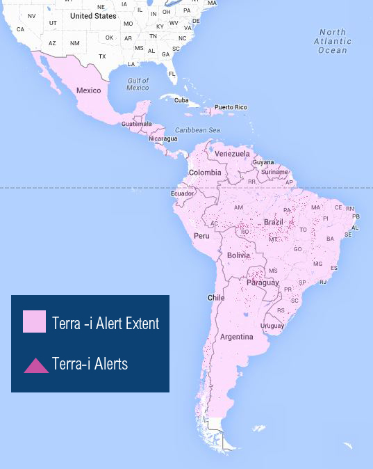 Geographic Coverage of Terra-i.
 Using Terra-i to Address Environmental Issues in Latin America
With monthly alerts for all of Latin America, Terra-i offers a unique opportunity to monitor local environmental issues such as illegal mining, which is a widespread driver of forest loss in parts of the Amazon Basin. For instance, the Madre de Dios Region of Peru has been the focus of Terra-i alerts for several years, as it became the hub for Peru’s gold industry. As international gold prices rose, and a new highway opened access to previously remote forest, unregulated and illegal mining activities in the area have led to an increase in forest clearing for mining sites. Terra-i data estimated that Madre de Dios lost 28,369 hectares (about 70,000 acres) of vegetation over an eight-year period (2004-2011), with an annual average loss of 3,546 ha (about 8,800 acres).
| Year | Peru | Madre de Dios |
|---|---|---|
| 2012 | 94837 | 8737 |
| 2013 | 108018 | 11325 |
| 2014 | 40356 | 3162 |
Vegetation decrease in hectares 2012-2014. Terra-i data shows that Peru has lost 243,111 ha (more than 600,000 acres) of vegetation since 2012, with 23,224 ha (more than 57,000 acres) of that loss (9.5 percent) in Madre de Dios alone.
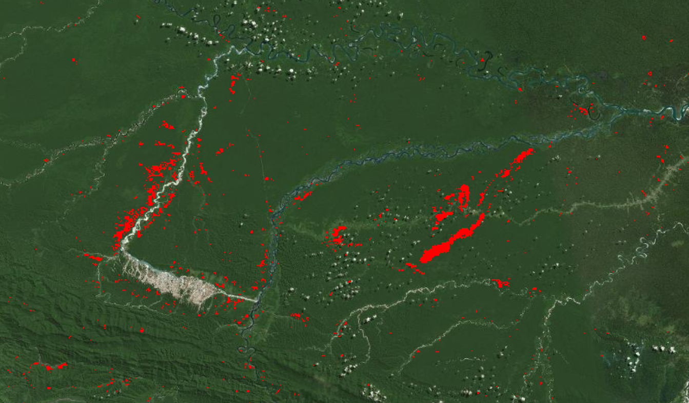
 Terra-i alerts surrounding major artisanal mine in Madre De Dios.
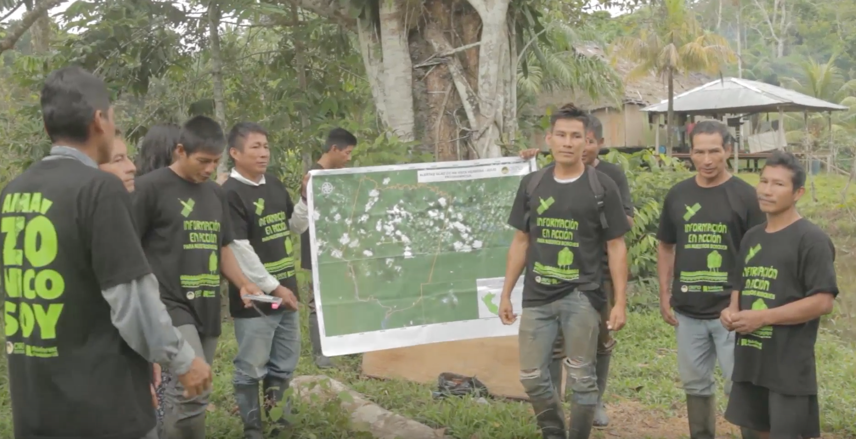
 Terra-i monitoring data can be used to inform efforts to address illegal mining in the region by helping to identify priority areas for action and document the seasonality of mining activities. Knowing the amount of forest loss can likewise help officials estimate assess the effectiveness of efforts to address illegal mining over time. The Ministry of Environment in Peru (MINAM) is actually using Terra-i alerts to identify new mining areas. Forest threats from illegal mining are not limited to Madre de Dios. GFW users can leverage Terra-i alerts to monitor: 1) The Peru-Colombia bilateral collaboration agreement to mitigate illegal mining and stop its spread in common border areas along the Putumayo River
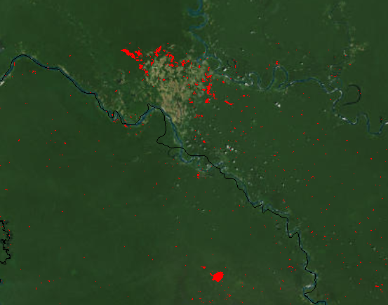 Cluster of Terra-i alerts on the Putumayo River (Peru Colombia Border area).
 2) The Peruvian government strategy to reform small-scale and artisanal mining in the Madre de Dios Region and incorporate these activities into the formal economy by addressing the negative economic, social and public health impacts
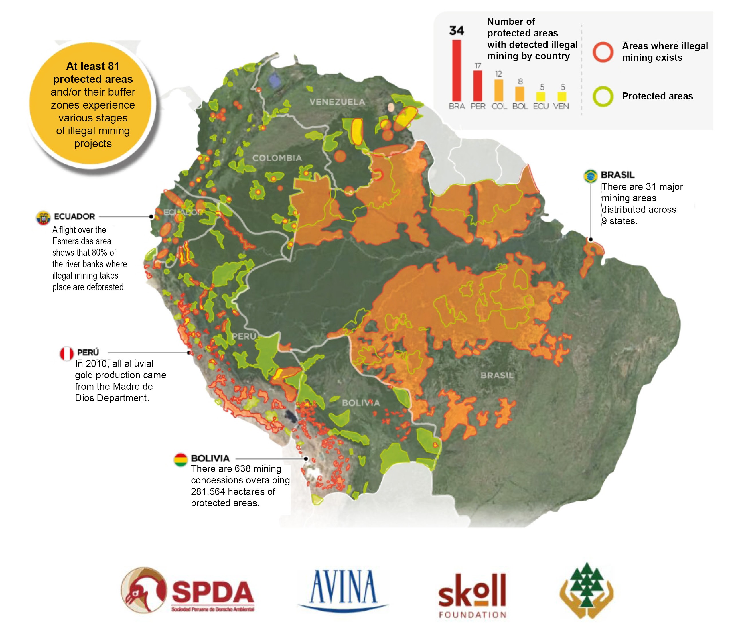 Sociedad Peruana de Derecho Ambiental (2014); The Reality of Illegal Mining in Amazonian Countries. Infographics. With support from AVINA-Skoll.
 3) The Ecuador-Peru-Colombia collaboration agreement that seeks to combat illegal mining in the tri-national border area through information sharing, coordination of law enforcement actions, and establishment of early warning systems By making Terra-i data accessible to the public, NGOs, academics, and watchdog groups, this new WRI-CIAT collaboration expands GFW’s geographic scope at finer resolution than previously available. Users can visualize, analyze, share Terra-i data through the GFW platform, and apply Terra-i to forest threats in Latin America. Terra-i data can be downloaded directly from their website.
Explore More Articles

Oct 16, 2019|Data and Research|5 minutes
Triumphs and Challenges of Using Deforestation Alerts in Peru
In 2016, Global Forest Watch (GFW) and the University of Maryland released the world’s most detailed satellite-based deforestation alerts. Since the launch, the GLAD alert system has expanded from just three countries to the entire tropical region and is accessed by hundreds of thousands of users through GFW. Peru’s Early Warning Alerts After using the GLAD deforestation alerts, […]
Dec 27, 2017|Data and Research|6 minutes
A Year in Review: Global Forest Watch Highlights from 2017
It’s been another busy year for Global Forest Watch! This year we focused on putting the right data into the hands of our users to support action on the ground. We added more local data and made it easier than ever for decision-makers and on-the-ground forest monitors to access the information they need through national […]
Explore More Articles


