- Data and Research
FORMA250: Global Forest Watch’s original near real-time alert system gets an upgrade
Jun 27, 2017||4 minutes
By Brookie Guzder-Williams When Global Forest Watch launched, FORMA (FORest Monitoring for Action) 500 was our first and only near real-time alert system. By analyzing NASA satellite images, FORMA 500 gave monthly updates of tree cover loss (the death or removal of trees, regardless of cause) across the forests of the moist tropics at 500 x 500 meter resolution.
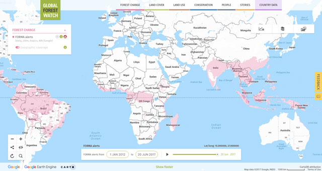 New FORMA 250 alerts cover moist and dry tropics. View data on the interactive map.
After two years, we have revamped the system to create FORMA 250—a more accurate, higher resolution offspring of the FORMA dataset that is updated daily. View the new FORMA dataset and subscribe for alerts on our interactive map.
How has FORMA 250 improved on the original?
FORMA 250 is an upgrade from the FORMA 500 in seven ways:
- Frequency. FORMA 250 is updated daily (the old version was updated monthly).
- Higher resolution. FORMA 250 detects tree cover loss at 250 x 250 meter resolution compared to the original’s 500-meter resolution. This means increased accuracy and fewer resources needed to confirm an alert. Instead of traipsing through a 500-meter by 500-meter area, park rangers in the thick of the Amazon can narrow their search down to an area a quarter of the size (about the size of 9 soccer fields).
- Expanded coverage. FORMA 250 covers both the moist and dry tropical forests (the original only covered moist forests).
- Clearing estimates. FORMA 250 estimates the percentage of tree cover loss within each pixel instead of a categorical “cleared” or “not cleared.” This gives forest monitors a more accurate estimate of the amount of forests being lost, and allows them to focus on regions of interest.
- Accuracy. Changes to the FORMA algorithm have greatly improved accuracy leading to fewer false positives. Moreover, the system is now refit annually to new University of Maryland annual tree cover loss data ensuring that predictions will continue to be accurate for years to come.
- FORMA Active Clearing Alerts. In addition to daily alerts, FORMA 250 produces Active Clearing Alerts, which highlight pixels where we believe forests are currently being lost.
How do daily updates work?
Similar to the original, FORMA 250 uses two data products from NASA’s MODIS sensor on the Aqua and Terra satellites—NDVI, which tracks changes in vegetation color every 16 days, and FIRMS, which detects fires daily. Unlike FORMA 500, FORMA 250 processes NDVI and FIRMS data separately, which allows it to produce alerts daily once new FIRMS data become available without waiting for the new NDVI data.
This also improves FORMA 250’s reliability. NDVI updates are often delayed, whereas FIRMS data is consistently updated daily. By decoupling NDVI and FIRMS data, FORMA 250 can reliably produce alerts daily using FIRMS, supplemented by NDVI when it becomes available.
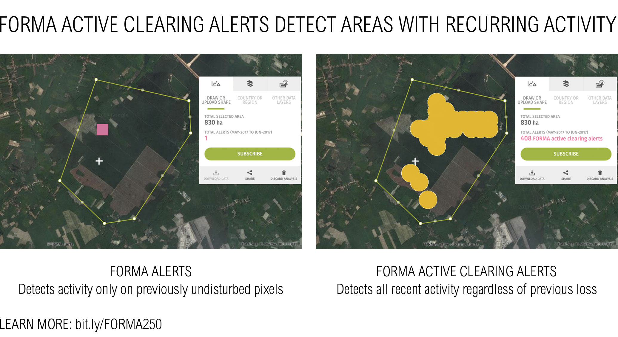
What are Active Clearing Alerts?
Many users are interested in all current deforestation activity, regardless of historical clearing. However, FORMA 250 alerts, like other alerting systems on GFW, only allows for a single alert per pixel. In practice this means that if at some point in the past there is initial activity triggering an alert, any subsequent tree cover loss will be ignored, no matter how large the clearing. FORMA Active Clearing Alerts capture all activity, regardless of historical loss (i.e. previously detected by FORMA alerts). This will be useful in cases where an alert was previously triggered by partial clearing of a pixel, which is now being further cleared, or in cases where vegetation has regenerated since the last alert and is now being cleared again.
View this area on Global Forest Watch.Taken together, FORMA Active Clearing Alerts and the daily updated FORMA 250 bring us closer to real-time monitoring than ever before. See how it works in forests around the world.
FORMA 250 on Google Earth Engine
FORMA 250 has been developed and operationalized on Google Earth Engine (GEE) providing us with an exciting new way to share our data. In addition to its GFW release, FORMA 250 will be made available through GEE. GEE users will be able to use this data to expand upon the work we have already done. Moreover, they will have access to additional data, such as the raw model variables and accuracy estimations.
Coming into focus
FORMA 250 brings greater transparency to the places around the world most affected by deforestation. More accurate, more frequently and reliably updated data means that forest guardians across the tropics have another tool at their disposal to help protect our richest, most globally important resources. View the data on Global Forest Watch.
Explore More Articles

Oct 16, 2019|Data and Research|5 minutes
Triumphs and Challenges of Using Deforestation Alerts in Peru
In 2016, Global Forest Watch (GFW) and the University of Maryland released the world’s most detailed satellite-based deforestation alerts. Since the launch, the GLAD alert system has expanded from just three countries to the entire tropical region and is accessed by hundreds of thousands of users through GFW. Peru’s Early Warning Alerts After using the GLAD deforestation alerts, […]
Dec 27, 2017|Data and Research|6 minutes
A Year in Review: Global Forest Watch Highlights from 2017
It’s been another busy year for Global Forest Watch! This year we focused on putting the right data into the hands of our users to support action on the ground. We added more local data and made it easier than ever for decision-makers and on-the-ground forest monitors to access the information they need through national […]
Explore More Articles


