- Data
We Now Have Unprecedented Access to Satellite Imagery. How Do We Turn This Into Action?
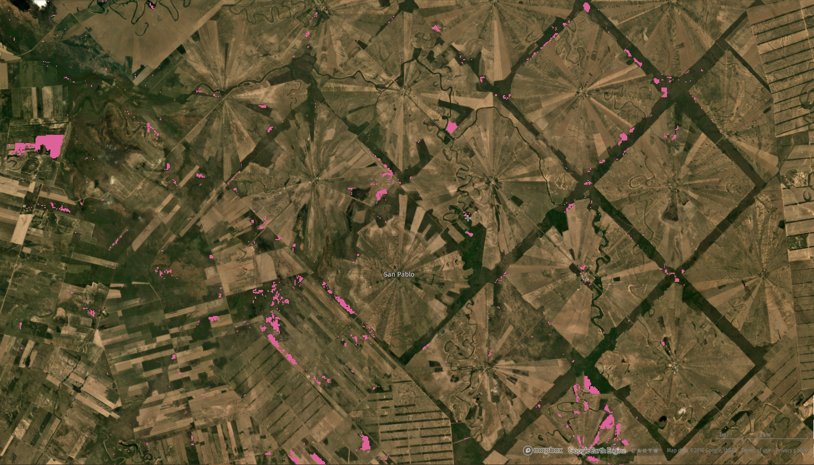
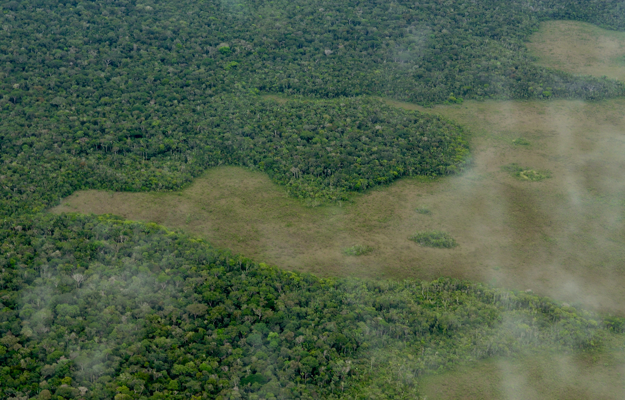
Radial agricultural settlement in Bolivia visible in high-resolution imagery. Image © 2019 Planet Labs Inc.
In September 2020, the Norwegian Government announced a contract providing public access to high-resolution satellite imagery of tropical forests. Never has the public had open access to satellite imagery with such high spatial and temporal resolution. But what does this data windfall mean for forest monitoring? How will it contribute to our goals of reducing tropical deforestation and restoring forest landscapes?
High-resolution imagery worth over $40 million, now available for free
Under this new contract, the earth imaging company Planet will provide free public access to 5-meter resolution satellite imagery covering the entire tropical forest region, to be updated monthly. Any person can view the mosaics—compilations of the clearest images taken the previous month— via websites like Global Forest Watch(GFW). More technically inclined users can download the data directly from Planet to conduct analyses and create derivative map products. The contract is valued at $43 million USD and is secured for a two-year period, with the possibility of extension for an additional two years.
At 5-meter resolution, we can monitor a single tree
Existing forest monitoring systems, GFW included, rely primarily on freely available medium-resolution imagery (10-30 meter pixels) from NASA’s Landsat or the European Space Agency’s Sentinel programs. At this scale, we can detect with reasonable accuracy where forests are cleared, and— over longer time periods— where forests have grown back. Landsat captures a complete picture of the Earth every eight days, although it may take many months or even years to capture a usable image in areas with high cloud cover, including many tropical rainforests.
At 5-meter resolution, we can see changes in forests on the scale of a single tree. Furthermore, Planet’s constellation of over 150 microsatellites image the entire Earth daily, which significantly increases the odds of capturing cloud-free images every month.
The high spatial and temporal resolution of Planet’s imagery opens a world of possibilities in forest monitoring. Small-scale and short-lived forest change dynamics like degradation due to selective logging may now be detectable. We may be able to more accurately monitor areas with less tree cover, such as the dry forests of the Brazilian Cerrado or African Sahel. Forest restoration, which often involves smaller and more incremental changes in tree cover, may be easier to track. We may also be able to better map crops and other land uses that replace forests, giving us a better understanding of what is causing deforestation.
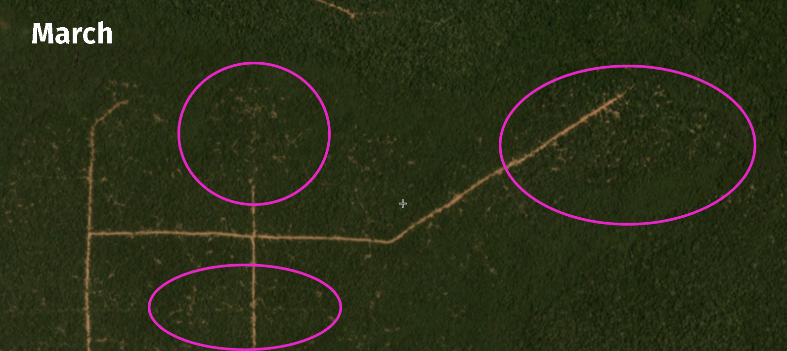 Planet images of the Republic of Congo show why forest degradation is difficult to monitor by satellite. The subtle impacts of selective logging can be seen in March, but the forest canopy closes again by June, erasing evidence of the disturbance that can be seen from satellites. Image © 2020 Planet Labs Inc.
Will better data mean safer forests?
For forest monitors around the world, it feels as if we’ve just won the lottery. But we still have work to do. That’s because satellites don’t protect or restore forests. People do. The Government of Norway has made high-resolution satellite data more accessible than ever before. Now we need a wide variety of actors—academic researchers, law enforcement, civil society groups, journalists and indigenous communities—to apply this data in ways that support conservation and restoration efforts. This will require significant innovation and investment beyond the $43 million used to purchase the imagery.
GFW will support this effort by ensuring universal access to the imagery via our suite of tools, which reached over 1.5 million people in 2019 alone across the Global Forest Watch website, the Forest Watcher mobile app and GFW Pro. The imagery can be easily used to support ongoing monitoring, investigation, advocacy, planning and enforcement efforts. For example, high-resolution imagery can be used to quickly verify and prioritize deforestation alerts generated from Landsat data for follow-up action, or provide visual proof of deforestation.
We are also eager to bring together the research community to identify how this imagery can be used to generate new data products that fill critical gaps in our knowledge about tropical forests. Can we better estimate forest degradation and related carbon emissions? Can we better identify landscapes offering the greatest potential for restoration? Can we build more confidence in performance-based conservation mechanisms like REDD+? I’m hopeful that Planet’s data will help us unlock answers to some of these critical questions.
We must act quickly to take advantage of this opportunity, the availability of which is uncertain beyond the next 2-4 years. While the problems we face often seem intractable and entrenched, GFW has shown us that technology, innovation and partnership can help pave the road to positive change. I am excited for what the future holds.
Imagery can be viewed on Global Forest Watch or be downloaded here.
Explore More Articles
Explore More Articles


