- Data
Tracking Deforestation in DRC’s Forest Concessions Is Complicated
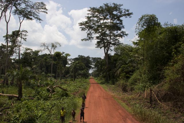
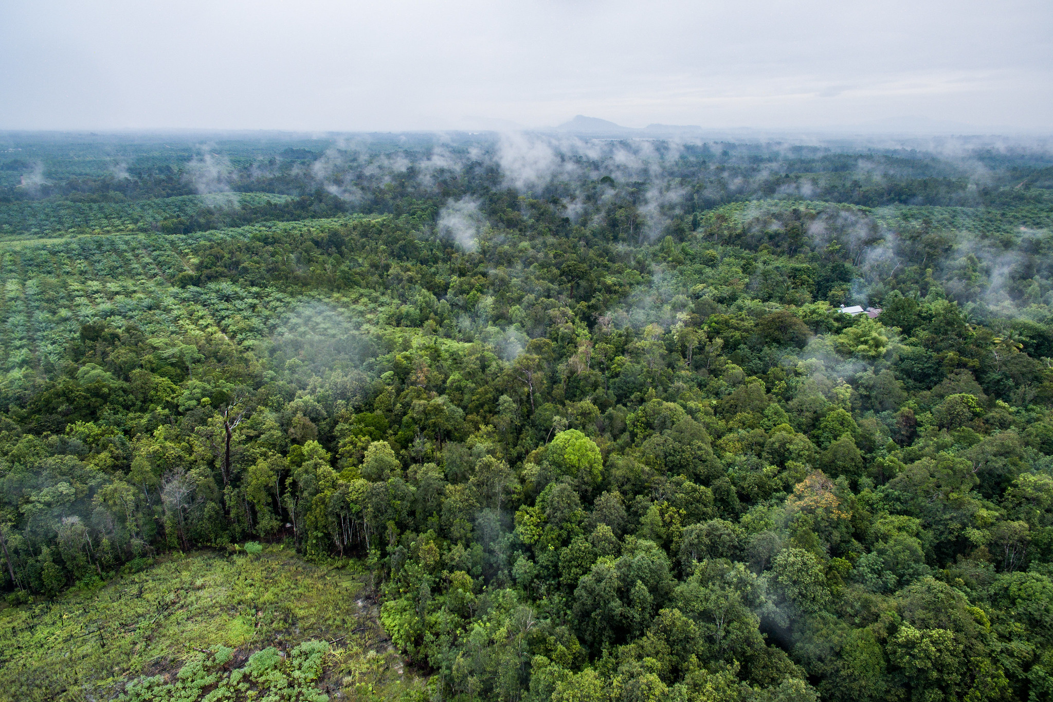
The Democratic Republic of Congo (DRC) contains more than half of the remaining Congo Basin rainforest, the second-largest tropical forest on Earth. These forests are increasingly threatened by slash-and-burn agriculture and logging for timber, charcoal and fuelwood. While most logging is carried out by small or medium-sized operators, industrial forest concessions cover 7 percent of the DRC’s forests — an area about the size of Cuba.
The University of Maryland recently found 2017 was a record year for tree cover loss in DRC, with 10 percent of that loss occurring within industrial forest concessions. This might imply that this loss is exclusively the result of logging. However, forest loss statistics within concession boundaries often do not tell the full story of what is happening there, or why.
To better understand the situation in DRC, we looked to the DRC’s Forest Atlas. This map-based platform, developed by WRI in partnership with the Congolese environment ministry, combines national data on land use with near real-time, satellite-based alerts about tree cover loss from the Global Forest Watch platform. Together, these data paint a more nuanced picture of what’s happening on the ground that can help law enforcement agencies and other forest monitors more effectively combat forest loss.
How Industrial Forest Concessions Work in DRC
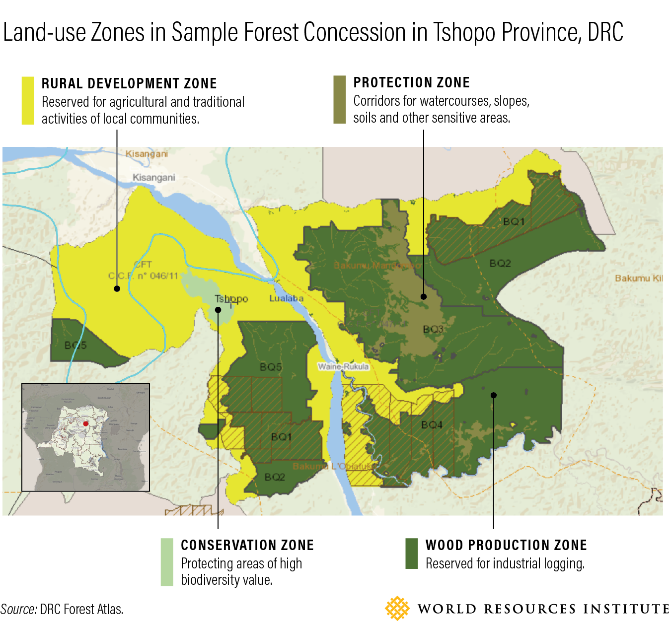
DRC’s industrial logging concessions give commercial timber operators rights to harvest timber from the forests within their boundaries, typically for export in the form of logs or sawn wood. A concessionaire must develop a management plan and designate separate zones within the concession for conservation, protection, timber production and rural development.
To illustrate how logging concessions are zoned and what this reveals about tree cover loss, we examined one concession in Tshopo province, shown on the map below.
What We Found
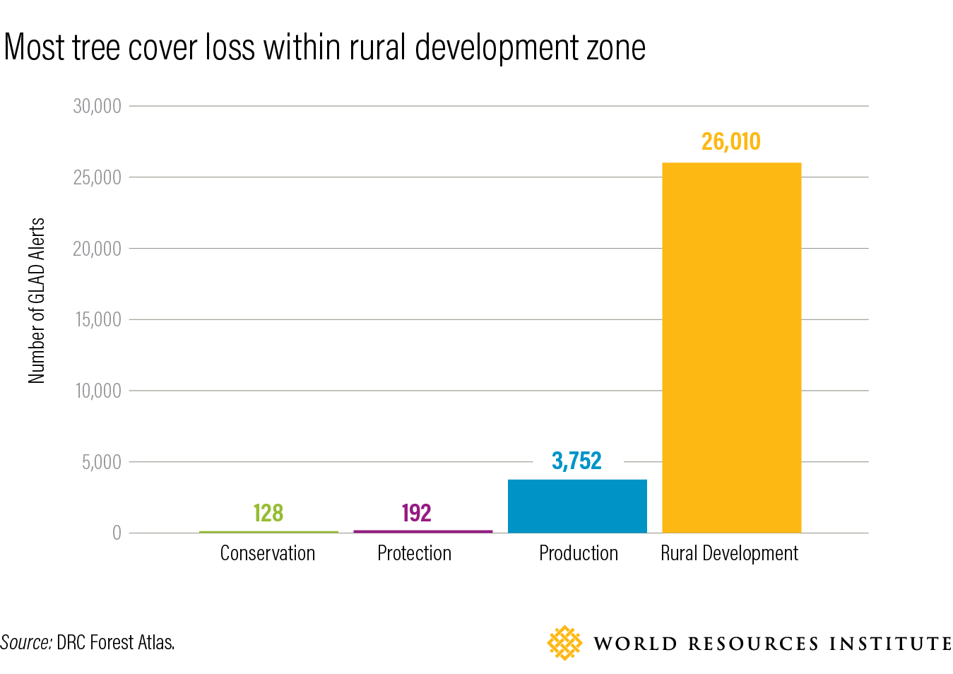
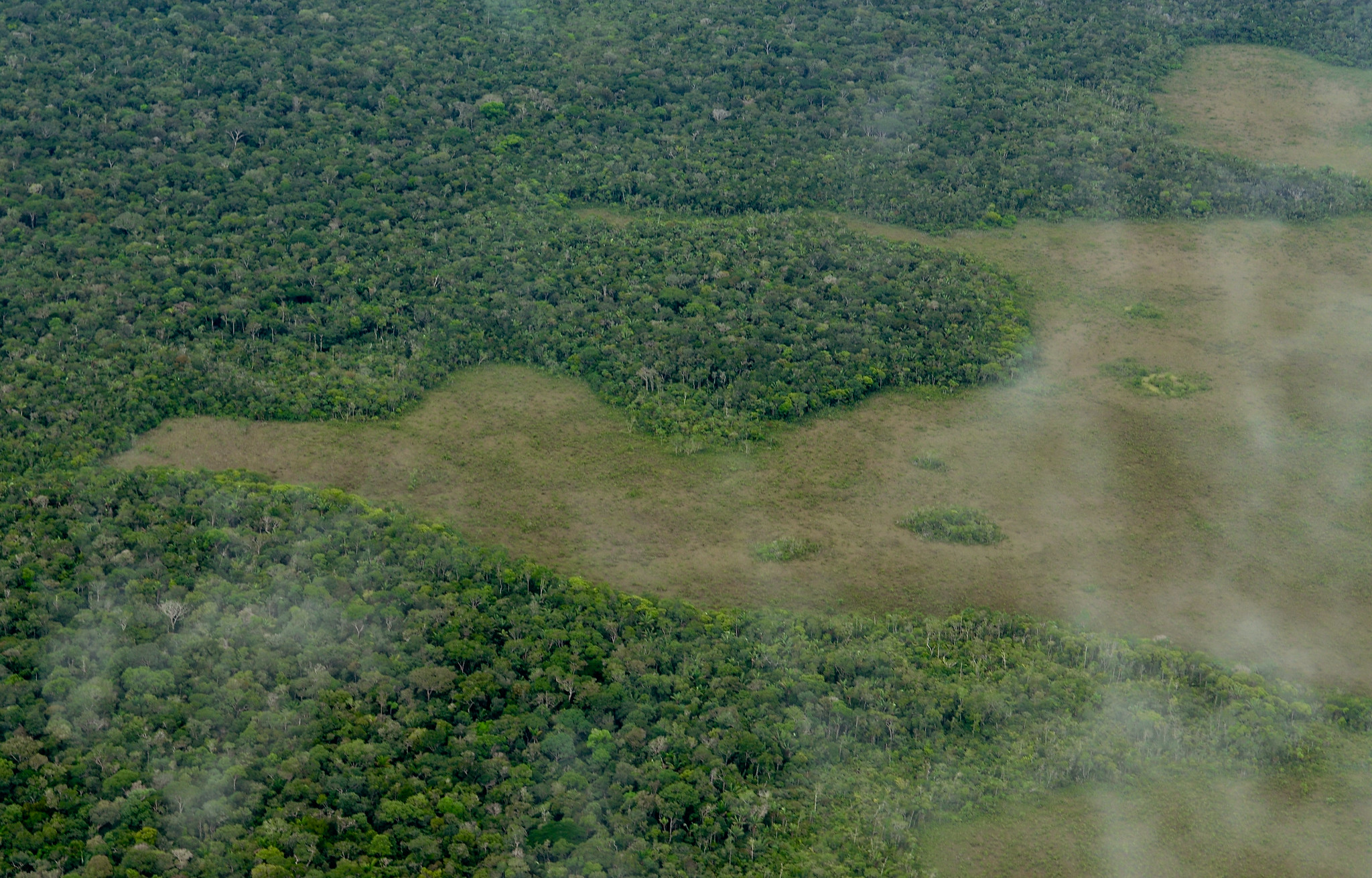
When we analyzed 2017 tree cover loss in the concession shown above, we found that 87 percent of tree cover loss occurred within the rural development zone, which covers 41 percent of the concession’s land area. Loss in this zone is to some extent “planned,” as this area explicitly allows rotational agriculture by rural communities.
It would also be wrong to define these alerts as true “deforestation,” which implies a net decrease in forest cover. Farmers in the Congo Basin practice rotational agriculture in which they regularly clear a patch of trees, farm the land until it loses productivity and then clear a new forest patch while leaving the first to regenerate. This practice has been going on for so long that most of the trees being cut are secondary forest that has regrown since the last cutting. Within the Tshopo concession we analyzed, 43 percent of were detected in secondary forest areas. This tree cover loss is not permanent deforestation, provided the forest has a chance to recover during the fallow portion of the cycle. Based on the location of the alerts within this concession, not all tree cover loss within the concession can be attributed to logging alone.
However, some of the detected forest loss deserves concern. Since the protection and conservation zones forbid development activities, the evidence of tree cover loss in those zones, while comparatively low, indicates unexpected loss that merits further investigation. This loss could be attributed to forest management activities, natural disturbance such as forest fires or other human activity.
Determining Cause of Forest Loss in Logging Areas Is Murky
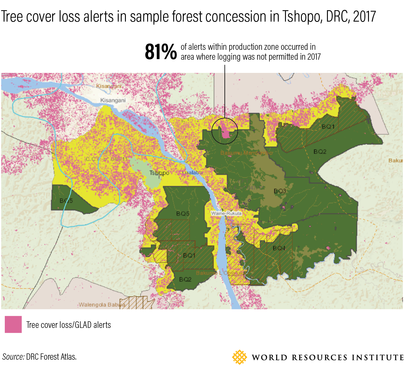
The concession owner is not allowed to log the entire production zone at the same time. Regulations require them to divide this space into five development blocks to be selectively logged over a 25-year period; these are further subdivided into five annual logging areas. Therefore, less than one-fifth of the production area can legally be logged in any given year. This context is critical to understanding whether observed loss in concession boundaries is likely a sanctioned part of logging operations or indicative of illegal logging or clearing.
In our concession example, 12 percent of overall alerts were detected within the production zone. Of these, 11 percent were detected within the approved logging area for 2017, while 81 percent were concentrated in the north of the concession — an area where no activities, logging or otherwise, were permitted that year. In fact, a field investigation by the Congolese environment ministry determined that this deforestation is due to clearing for new oil palm fields established without the knowledge of the concession operator.
Satellite Data Is the Start — Not the End
Monitoring what’s happening in forest concessions around the world is critical to understanding the big picture on deforestation and its causes. Satellite data can tell us where to look, but as our concession example shows, drawing definitive conclusions about forest loss requires understanding context and using satellite data in conjunction with other sources of information. In the DRC and other countries with Forest Atlases, overlaying tree cover loss data with spatial planning data can help governments and other forest users better interpret what’s really happening on the ground and enforce the law.
In a country the size of Western Europe, with limited infrastructure and understaffed, underpaid law enforcement, the Forest Atlas helps fill the DRC’s historic information void by making it easier than ever to detect and combat unexpected deforestation. Our analysis of tree cover within one forest concession is a drop in the bucket; to truly keep tabs on what is going on in DRC’s forests, resource managers — from government ministries to private companies — must step up and do the same.
Explore More Articles
Explore More Articles


