Filter by category and topics
SHOWING 6 OF 19 POSTS
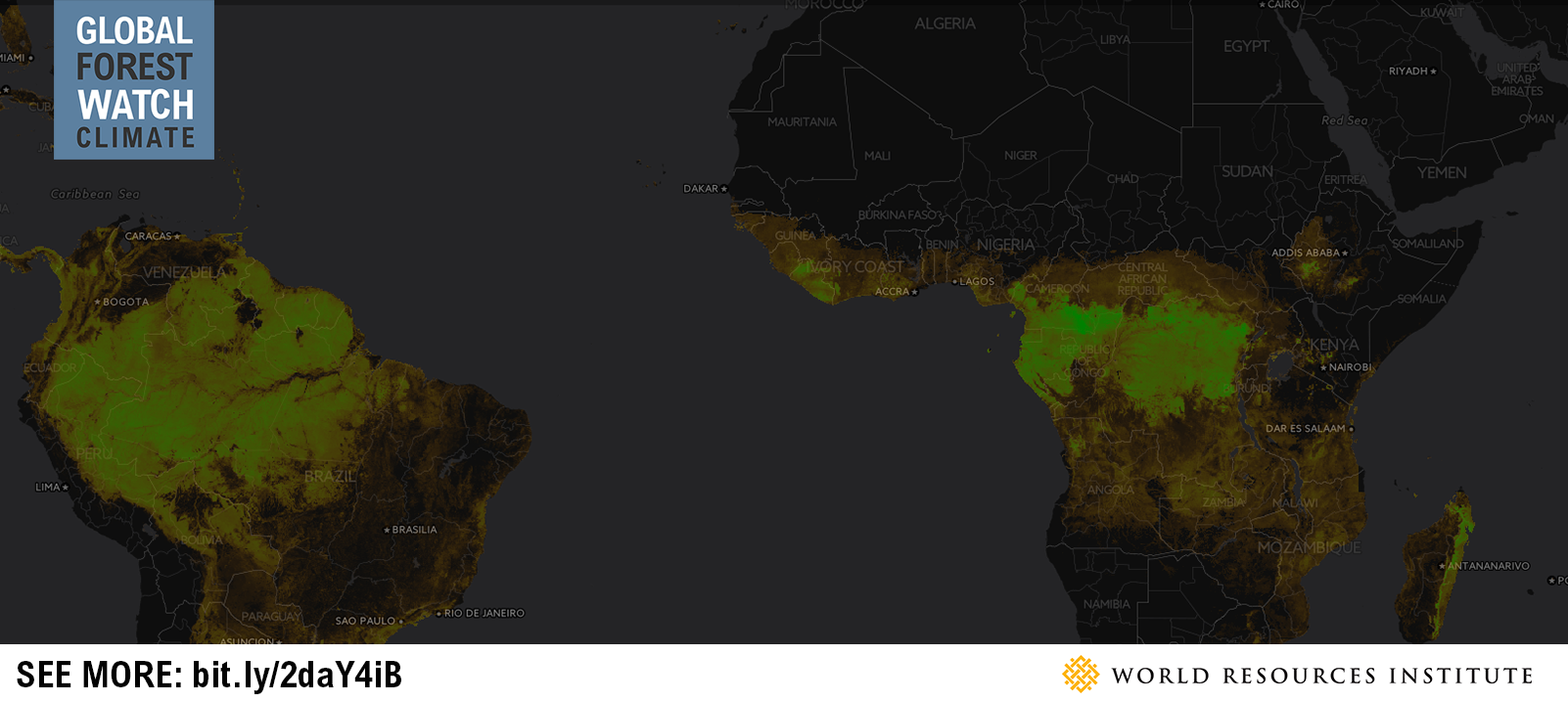
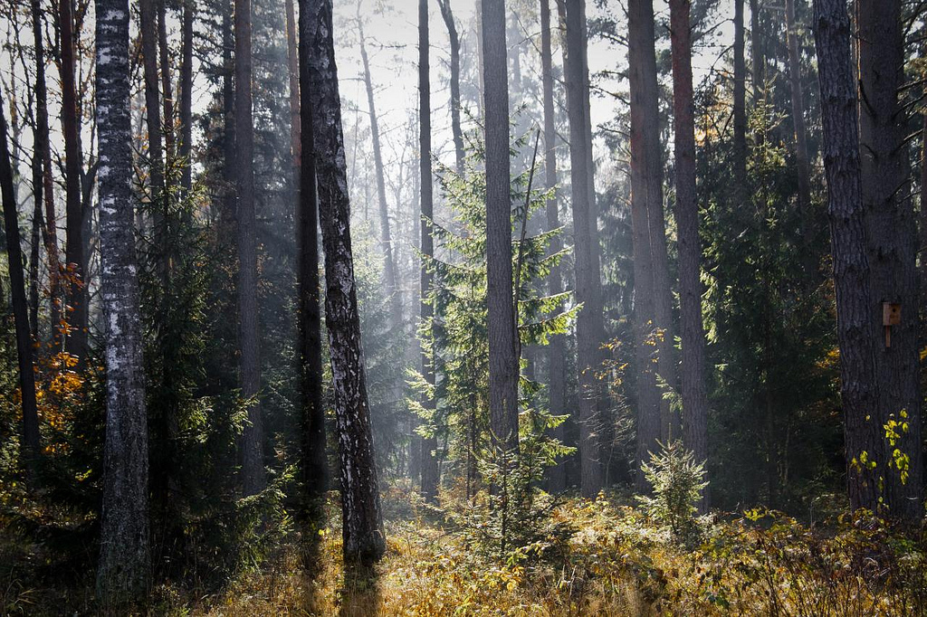
Map of the Week: Tracking Logging Roads in the Congo Basin
By Sofia Soto Reyes Western Lowland Gorilla (in captivity). Source: Heather Paul (Flickr). License available here. Located in western equatorial Africa is a vast expanse of green that blankets six Congo Basin countries: Cameroon, Central African Republic, Equatorial Guinea, Gabon, Democratic Republic of the Congo and Republic of the Congo. Second only to the Amazon rainforest […]
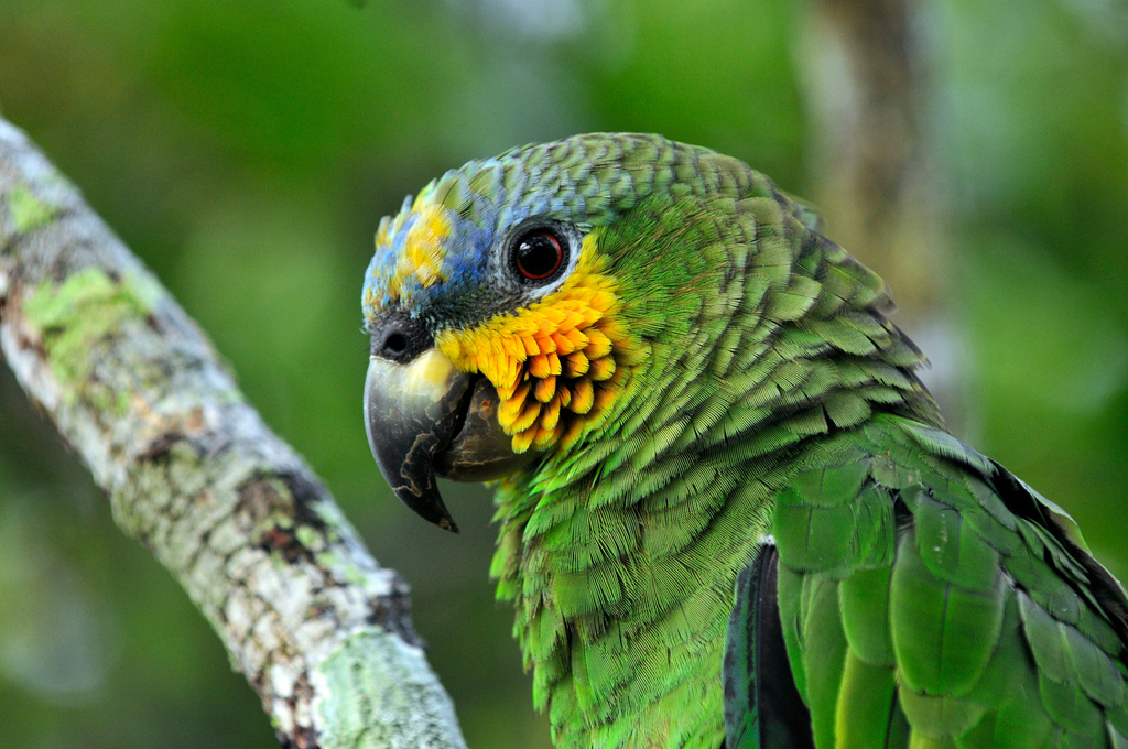
Map of the Week: GLAD Alerts show recent loss in Brazil’s Jamanxim National Park
By Sofia Soto Reyes Parrot in the Amazon, Brazil. Source: Neil Palmer/CIAT for Center for International Forestry Research (CIFOR/Flickr). License available here. The Amazon Rainforest is home to one-tenth of all plant and animal species on the planet and produces one-fifth of all the oxygen we breathe. Monitoring and protecting such a rich natural resource […]
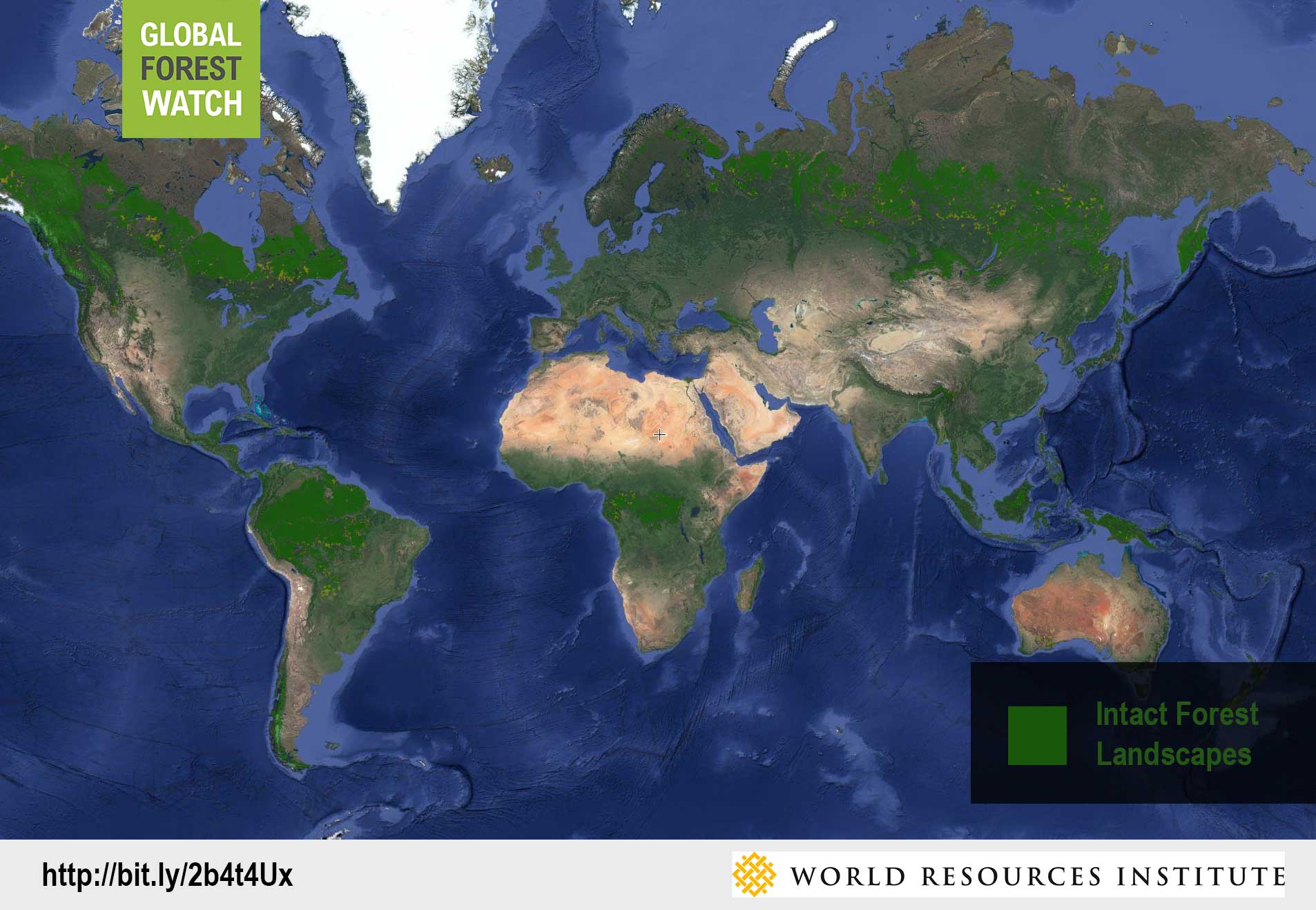
Map of the Week: Using GLAD Alerts to monitor Intact Forest Landscapes in Peru
By Sofia Soto Reyes Peru ranks as one of the ten most biodiverse countries on the planet, with more than half of its territory made up of the Amazon Rainforest. The Ucayali region, named for the Ucayali River, which serves as the main mode of transport for Peru’s timber trade, flows through a part of the Peruvian Amazon that is designated as an Intact Forest Landscape (IFL). Global Forest Watch’s Intact Forest Landscapes layer displays the extent of world’s last remaining undisturbed forests, […]
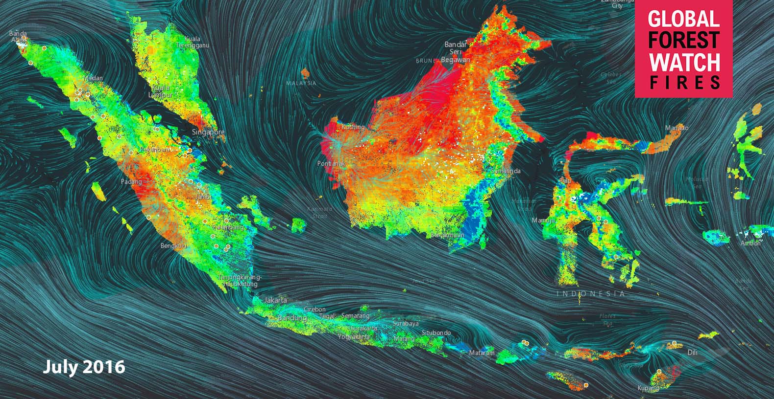
Map of the Week: Viewing Historic Fire Risk in Indonesia
By Sofia Soto Reyes Last year, Indonesia’s fire season was one of the worst on record. As such, vigilance in monitoring weather conditions is crucial. This task has been made easier as GFW Fires recently released a Fire Risk map. Satellite-based data on temperature, humidity, and rainfall is used to estimate how wet or dry tree […]
Map of the Week: Large-Scale Logging Threatens Europe’s Last Primeval Forest
By Liz Cole Białowieża Forest in Belarus. Source: Marc Veraart (Flickr). One of the world’s oldest and largest primeval forests is under threat due to recent approval of industrial logging in Poland. Spanning the border of Poland and Belarus, the Białowieża Forest is the last of the lowland forests, which covered all of Europe following […]
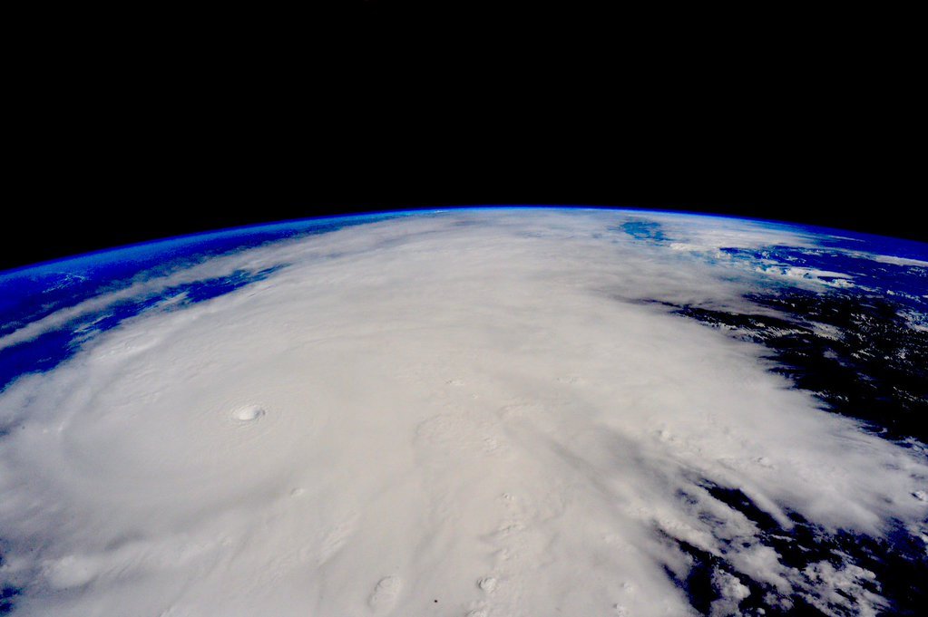
Map of the Week: Tracking Hurricane Patricia in Near Real-Time
Tracking Hurricane Patricia in Near Real-Time As Hurricane Patricia – the strongest hurricane ever recorded – prepares to make landfall in Mexico, people everywhere can use Global Forest Watch tools to track hurricane winds in the face of this critical national emergency. Global Forest Watch Fires uses data from the U.S. National Oceanic and Atmospheric […]


